MyTopo
Tortugas Mountain New Mexico US Topo Map
Couldn't load pickup availability
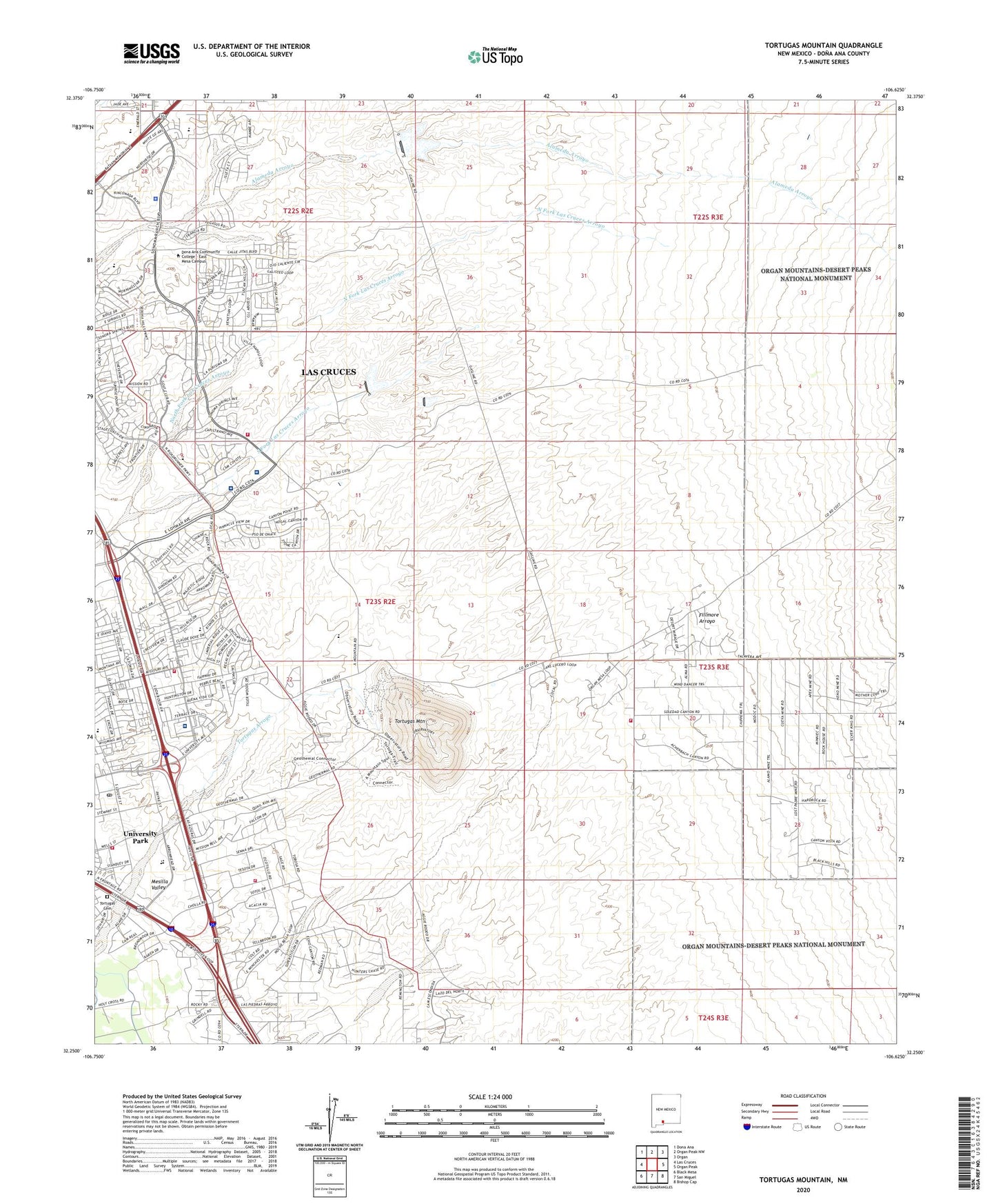
2023 topographic map quadrangle Tortugas Mountain in the state of New Mexico. Scale: 1:24000. Based on the newly updated USGS 7.5' US Topo map series, this map is in the following counties: Doña Ana. The map contains contour data, water features, and other items you are used to seeing on USGS maps, but also has updated roads and other features. This is the next generation of topographic maps. Printed on high-quality waterproof paper with UV fade-resistant inks.
Quads adjacent to this one:
West: Las Cruces
Northwest: Dona Ana
North: Organ Peak NW
Northeast: Organ
East: Organ Peak
Southeast: Bishop Cap
South: San Miguel
Southwest: Black Mesa
This map covers the same area as the classic USGS quad with code o32106c6.
Contains the following named places: 10096 Water Well, 88003, 88011, A Mountain-Inman Pit, Acres De Dios Cemetery, Advanced Care Hospital of Southern New Mexico, Alameda Dam, Burn Pit, City 24 Water Well, City Water Well 9, Cox Pit Number Two, Dona Ana County Fire Department District 2, Fillmore, Fillmore Site Number One Dam, Hoffer MN Prospect, Jesse Well, Jones, Las Alturas Estates Wells, Las Alturas Fire Department, Las Cruces Division, Las Cruces Fire Department Station 4, Little Dam, Manganese Number One Mine, Manganese Number Two Mine, Memorial General Hospital Helistop, Memorial Medical Center, Mesilla Valley Mall, MountainView Regional Medical Center, New Mexico State Police District 4 Las Cruces, New Mexico State University Fire and Emergency Services, NMSU 3 Water Well, NMSU 4 Water Well, NMSU 9 Water Well, North Fork Dam, North Fork Las Cruces Arroyo, Rehabilitation Hospital of Southern New Mexico, Santiago, SK Standard Mine, South Fork Dam, South Fork Las Cruces Arroyo, Tortugas Arroyo, Tortugas Cemetery, Tortugas Mine, Tortugas Mountain, Tortugas Site Number One Dam, Tortugas Watershed Site Number Two Dam, Triangle Placer Mine, Triangle Placer Minning Claim, University Park Census Designated Place, University Park Post Office, Well 17 Water Well