MyTopo
Fitzpatricks New Mexico US Topo Map
Couldn't load pickup availability
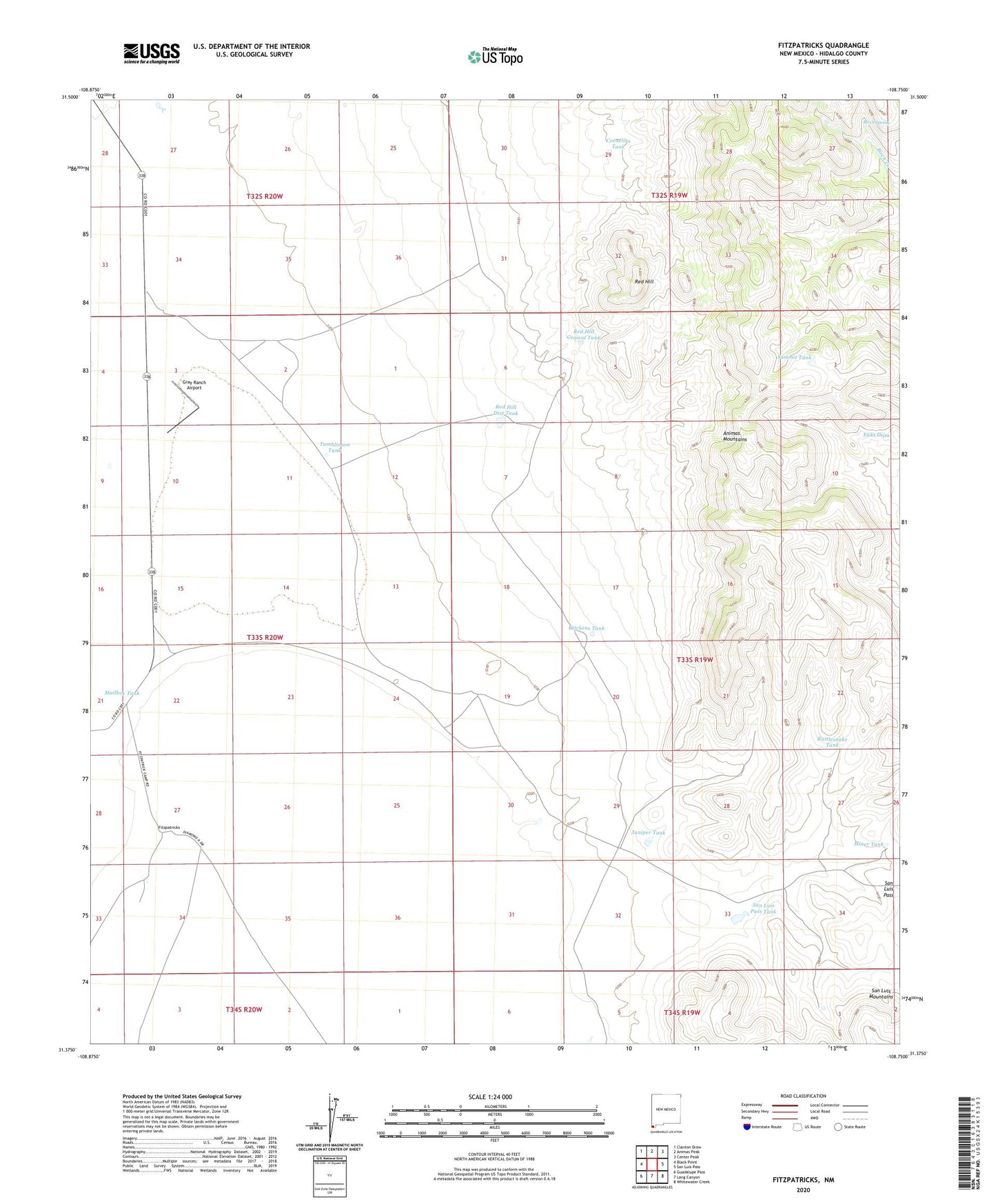
2023 topographic map quadrangle Fitzpatricks in the state of New Mexico. Scale: 1:24000. Based on the newly updated USGS 7.5' US Topo map series, this map is in the following counties: Hidalgo. The map contains contour data, water features, and other items you are used to seeing on USGS maps, but also has updated roads and other features. This is the next generation of topographic maps. Printed on high-quality waterproof paper with UV fade-resistant inks.
Quads adjacent to this one:
West: Black Point
Northwest: Clanton Draw
North: Animas Peak
Northeast: Center Peak
East: San Luis Pass
Southeast: Whitewater Creek
South: Lang Canyon
Southwest: Guadalupe Pass
This map covers the same area as the classic USGS quad with code o31108d7.
Contains the following named places: Birch Spring, Cornelius Tank, Fitzpatricks, Fitzpatricks Well, Gray Ranch Airport, Juniper Tank, Kitchens Tank, Mailbox Tank, Miner Tank, Rattlesnake Tank, Red Hill, Red Hill Cement Tank, Red Hill Dirt Tank, San Luis Pass Tank, Schoolhouse Tank, Summit Tank, Tumblinson Tank