MyTopo
Black River Village New Mexico US Topo Map
Couldn't load pickup availability
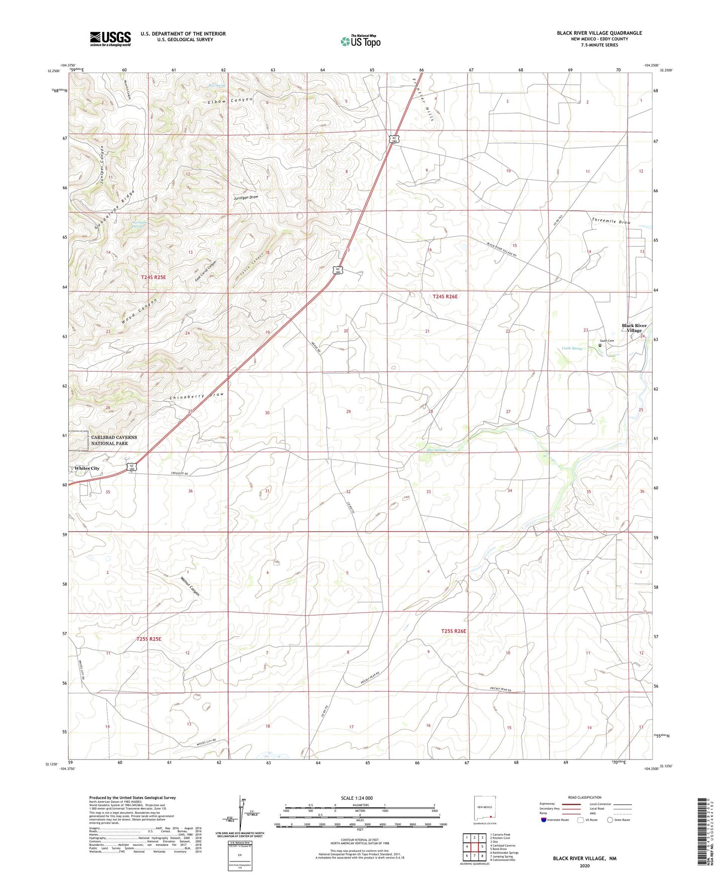
2020 topographic map quadrangle Black River Village in the state of New Mexico. Scale: 1:24000. Based on the newly updated USGS 7.5' US Topo map series, this map is in the following counties: Eddy. The map contains contour data, water features, and other items you are used to seeing on USGS maps, but also has updated roads and other features. This is the next generation of topographic maps. Printed on high-quality waterproof paper with UV fade-resistant inks.
Quads adjacent to this one:
West: Carlsbad Caverns
Northwest: Carnero Peak
North: Kitchen Cove
Northeast: Otis
East: Bond Draw
Southeast: Cottonwood Hills
South: Jumping Spring
Southwest: Rattlesnake Springs
Contains the following named places: 06613 Water Well, 06614 Water Well, 06615 Water Well, 06618 Water Well, 07039 Water Well, 10301 Water Well, 10471 Water Well, 20054 Water Well, 20056 Water Well, 20058 Water Well, 20059 Water Well, 20070 Water Well, Anna B Byrd, Black River Village, Blue Spring, Blue Spring Farm, Box Spring, Carlsbad Cavern Airpark, Castle Spring, Chinaberry Draw, Elbow Well, Elliot Ranch, Ewing Place, Fence Canyon, Goat Corral Canyon, Judkins Ranch, Jurnigan Draw, Jurnigan Spring, Old Duran Ranch, Old Pardue Ranch, Sims Ranch, Smith Blue Spring Ranch, South Cemetery, Tres Rios Christian Growth Center, Walnut Canyon, Whites City Census Designated Place, Wood Canyon, Woodruff Well