MyTopo
Kitchen Cove New Mexico US Topo Map
Couldn't load pickup availability
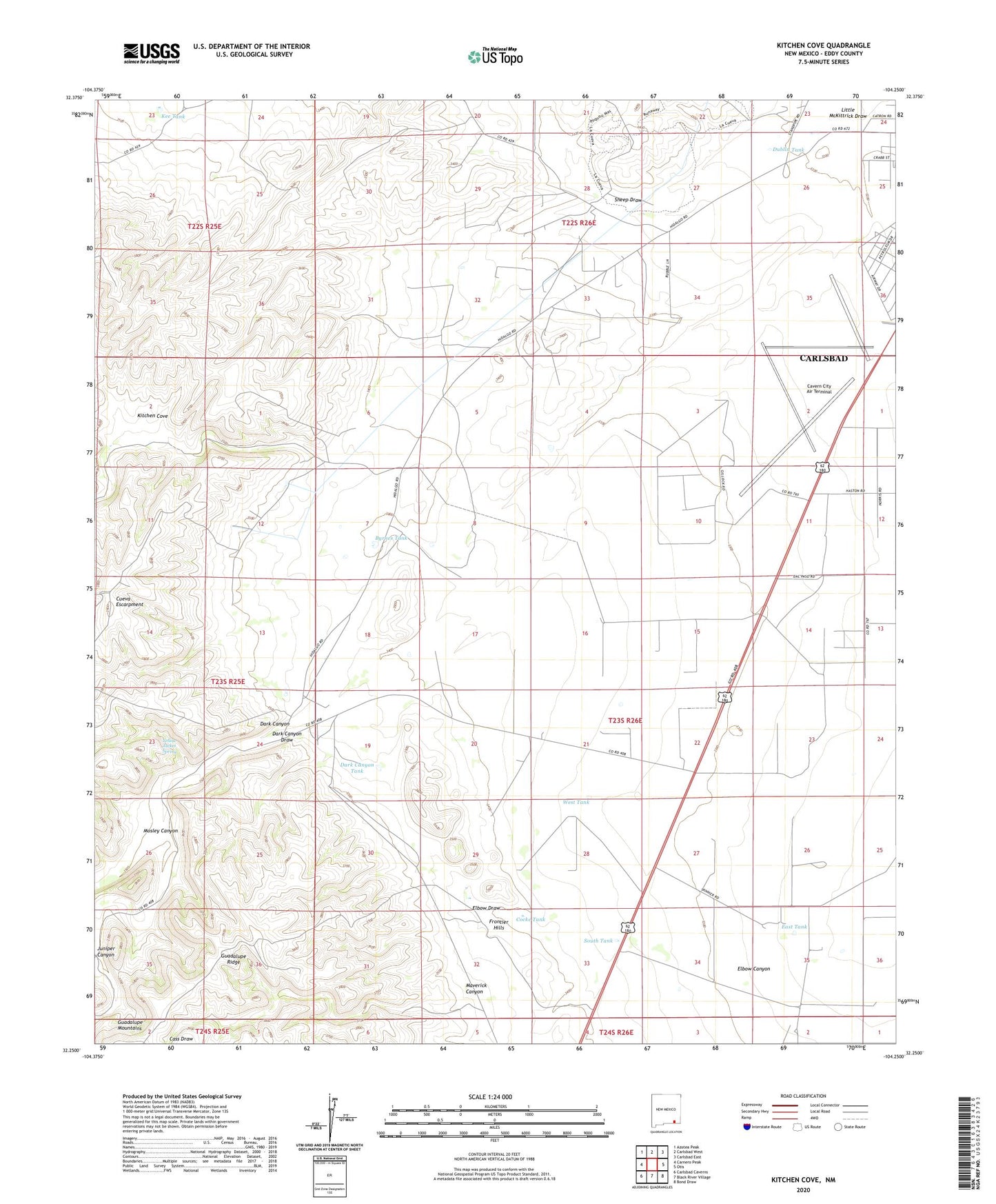
2023 topographic map quadrangle Kitchen Cove in the state of New Mexico. Scale: 1:24000. Based on the newly updated USGS 7.5' US Topo map series, this map is in the following counties: Eddy. The map contains contour data, water features, and other items you are used to seeing on USGS maps, but also has updated roads and other features. This is the next generation of topographic maps. Printed on high-quality waterproof paper with UV fade-resistant inks.
Quads adjacent to this one:
West: Carnero Peak
Northwest: Azotea Peak
North: Carlsbad West
Northeast: Carlsbad East
East: Otis
Southeast: Bond Draw
South: Black River Village
Southwest: Carlsbad Caverns
This map covers the same area as the classic USGS quad with code o32104c3.
Contains the following named places: 10215 Water Well, 10218 Water Well, 10220 Water Well, 10221 Water Well, 10257 Water Well, 10258 Water Well, 10260 Water Well, 10261 Water Well, 10262 Water Well, 10264 Water Well, 10267 Water Well, 10268 Water Well, 10411 Water Well, 10416 Water Well, Byrnes Tank, Carlsbad Army Air Field, Carlsbad Fire Department Station 6, Carlsbad Pit, Cavern City Air Terminal, Cocke Tank, Cueva Escarpment, Dark Canyon, Dark Canyon Tank, Dublin Tank, Dublin Well, East Tank, Eddy County Pits, Elbow Canyon, Elbow Draw, Frontier Hills, Juniper Canyon, Kee Tank, King Ranch, Kitchen Cove, Little McKittrick Draw, Lovejoy Ranch, Maverick Canyon, Mosley Canyon, Sheep Draw, South Tank, West Tank, Yellow Jacket Spring