MyTopo
Rattlesnake Springs New Mexico US Topo Map
Couldn't load pickup availability
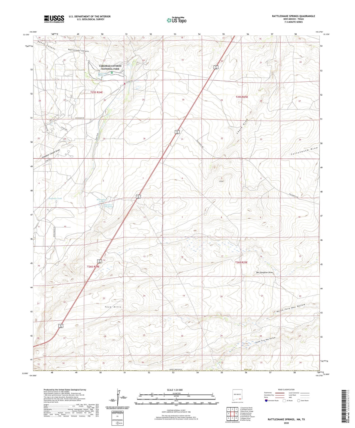
2023 topographic map quadrangle Rattlesnake Springs in the state of New Mexico. Scale: 1:24000. Based on the newly updated USGS 7.5' US Topo map series, this map is in the following counties: Eddy, Culberson. The map contains contour data, water features, and other items you are used to seeing on USGS maps, but also has updated roads and other features. This is the next generation of topographic maps. Printed on high-quality waterproof paper with UV fade-resistant inks.
Quads adjacent to this one:
West: Grapevine Draw
Northwest: Serpentine Bends
North: Carlsbad Caverns
Northeast: Black River Village
East: Jumping Spring
Southeast: Outlaw Spring
South: Alligator Draw
Southwest: South Rector Canyon
Contains the following named places: Ballard Ranch, Bottomless Lake Spring, Bottomless Lakes, Butcher Well, C P Hill, Circle K Ranch, Hoffman Tank, Mayes Ranch, Nuevo Canyon, Old C P Ranch, Old Wallace Smith, Rattlesnake Canyon, Rattlesnake Springs, Rattlesnake Springs Cemetery, Rattlesnake Springs Picnic Area, Slaughter Canyon Draw, Whites City Volunteer Fire Department Station 2, Yeso Hills