MyTopo
Otis New Mexico US Topo Map
Couldn't load pickup availability
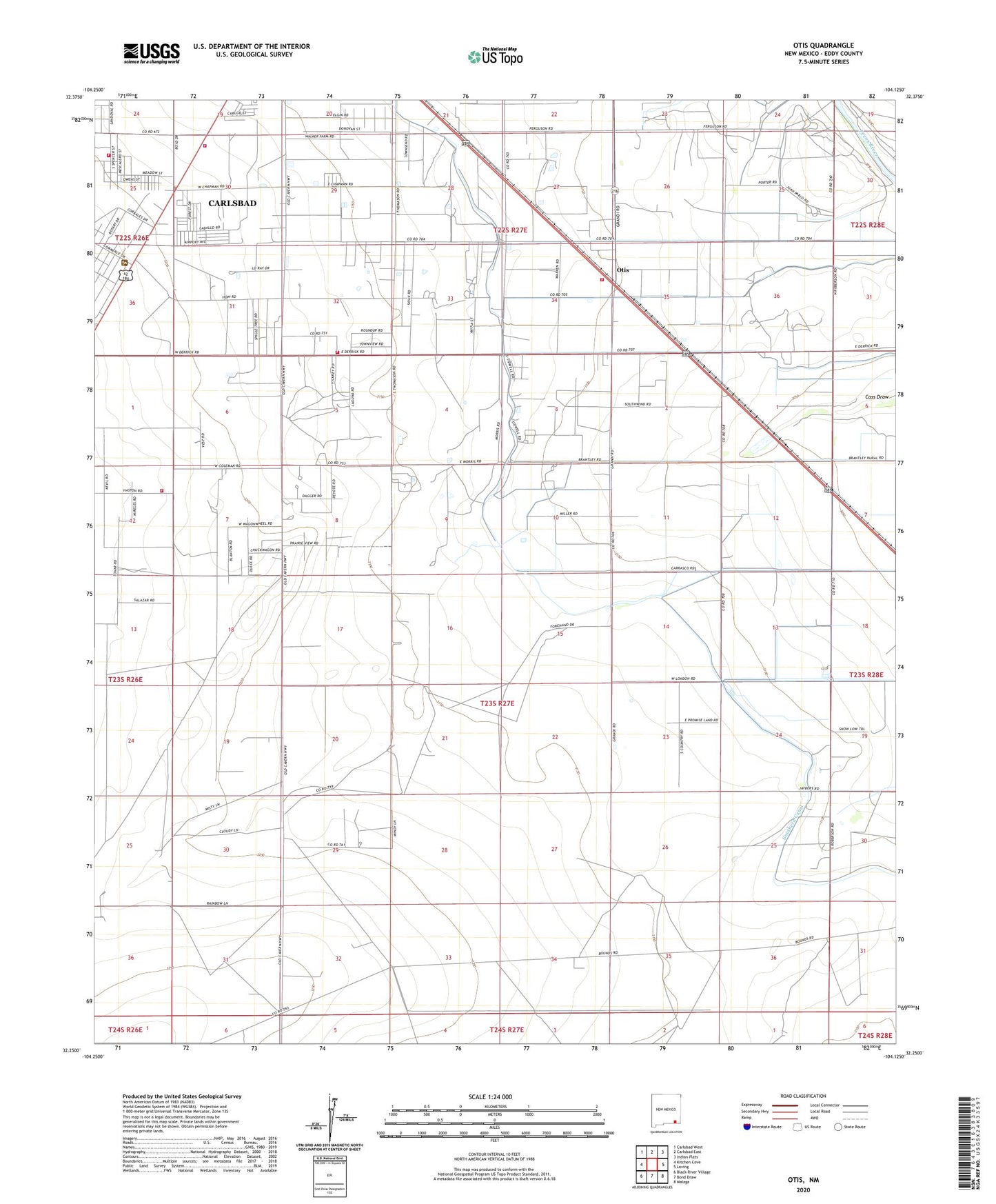
2023 topographic map quadrangle Otis in the state of New Mexico. Scale: 1:24000. Based on the newly updated USGS 7.5' US Topo map series, this map is in the following counties: Eddy. The map contains contour data, water features, and other items you are used to seeing on USGS maps, but also has updated roads and other features. This is the next generation of topographic maps. Printed on high-quality waterproof paper with UV fade-resistant inks.
Quads adjacent to this one:
West: Kitchen Cove
Northwest: Carlsbad West
North: Carlsbad East
Northeast: Indian Flats
East: Loving
Southeast: Malaga
South: Bond Draw
Southwest: Black River Village
This map covers the same area as the classic USGS quad with code o32104c2.
Contains the following named places: Carlsbad Fire Department Station 4, Cass Draw Site Number One Dam, Cass Draw Site Number Two Dam, Cavern City Dragway, Cuba Cemetery, Forehand Ranch, Joel Volunteer Fire Department Station 2, Joel Volunteer Fire Department Station 3, Joel Volunteer Fire Department Station 4, Municipal Lake, Municipal Tansill Lake Dam, Otis, Otis Post Office, Otis Volunteer Fire Department Station 1