MyTopo
Boiler Gap New Mexico US Topo Map
Couldn't load pickup availability
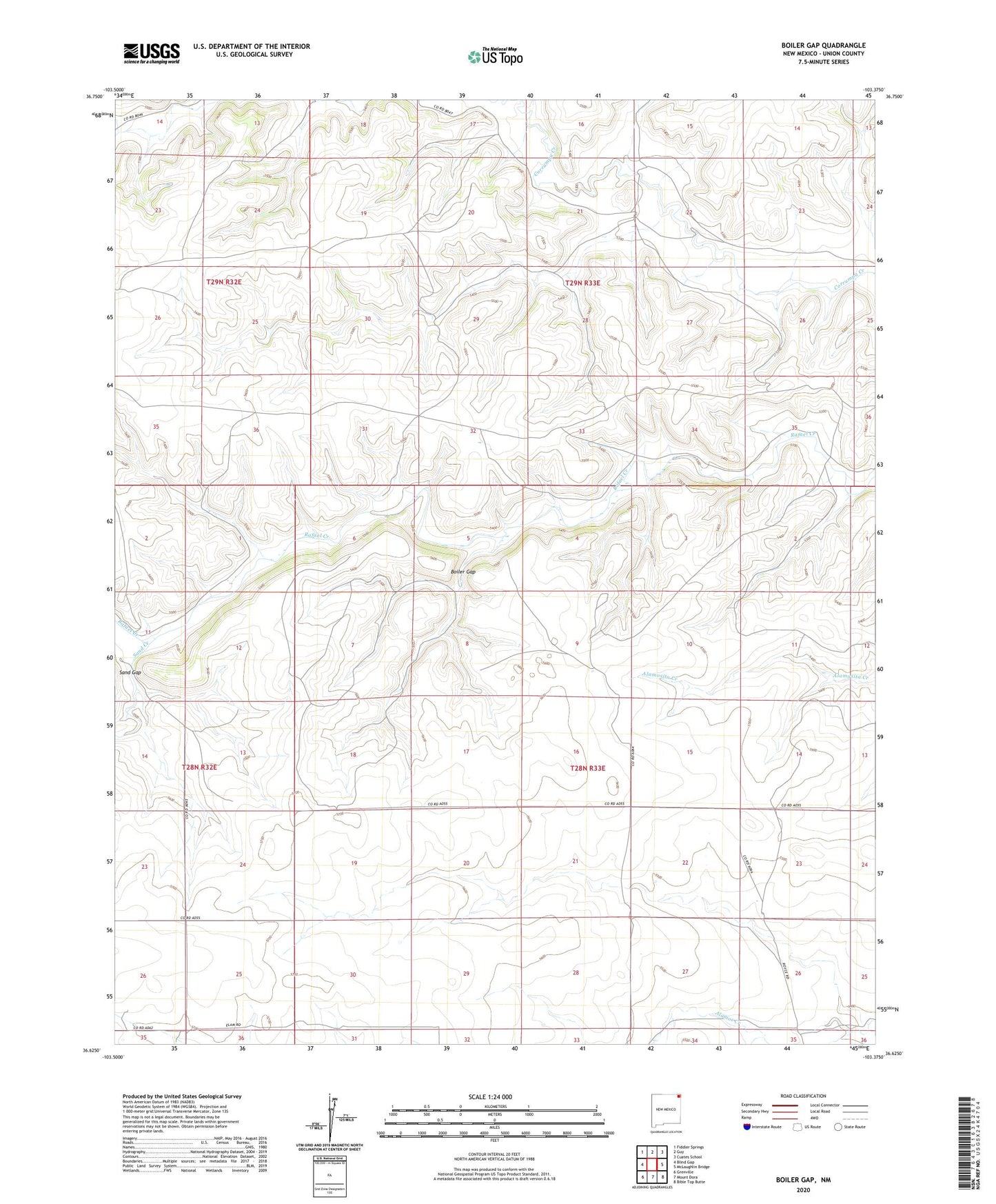
2023 topographic map quadrangle Boiler Gap in the state of New Mexico. Scale: 1:24000. Based on the newly updated USGS 7.5' US Topo map series, this map is in the following counties: Union. The map contains contour data, water features, and other items you are used to seeing on USGS maps, but also has updated roads and other features. This is the next generation of topographic maps. Printed on high-quality waterproof paper with UV fade-resistant inks.
Quads adjacent to this one:
West: Blind Gap
Northwest: Fiddler Springs
North: Guy
Northeast: Cuates School
East: McLaughlin Bridge
Southeast: Bible Top Butte
South: Mount Dora
Southwest: Grenville
This map covers the same area as the classic USGS quad with code o36103f4.
Contains the following named places: Boiler Gap, Sand Creek, Sand Gap, Tellott Windmill, Thomas, Vialpondo Windmill