MyTopo
Grenville New Mexico US Topo Map
Couldn't load pickup availability
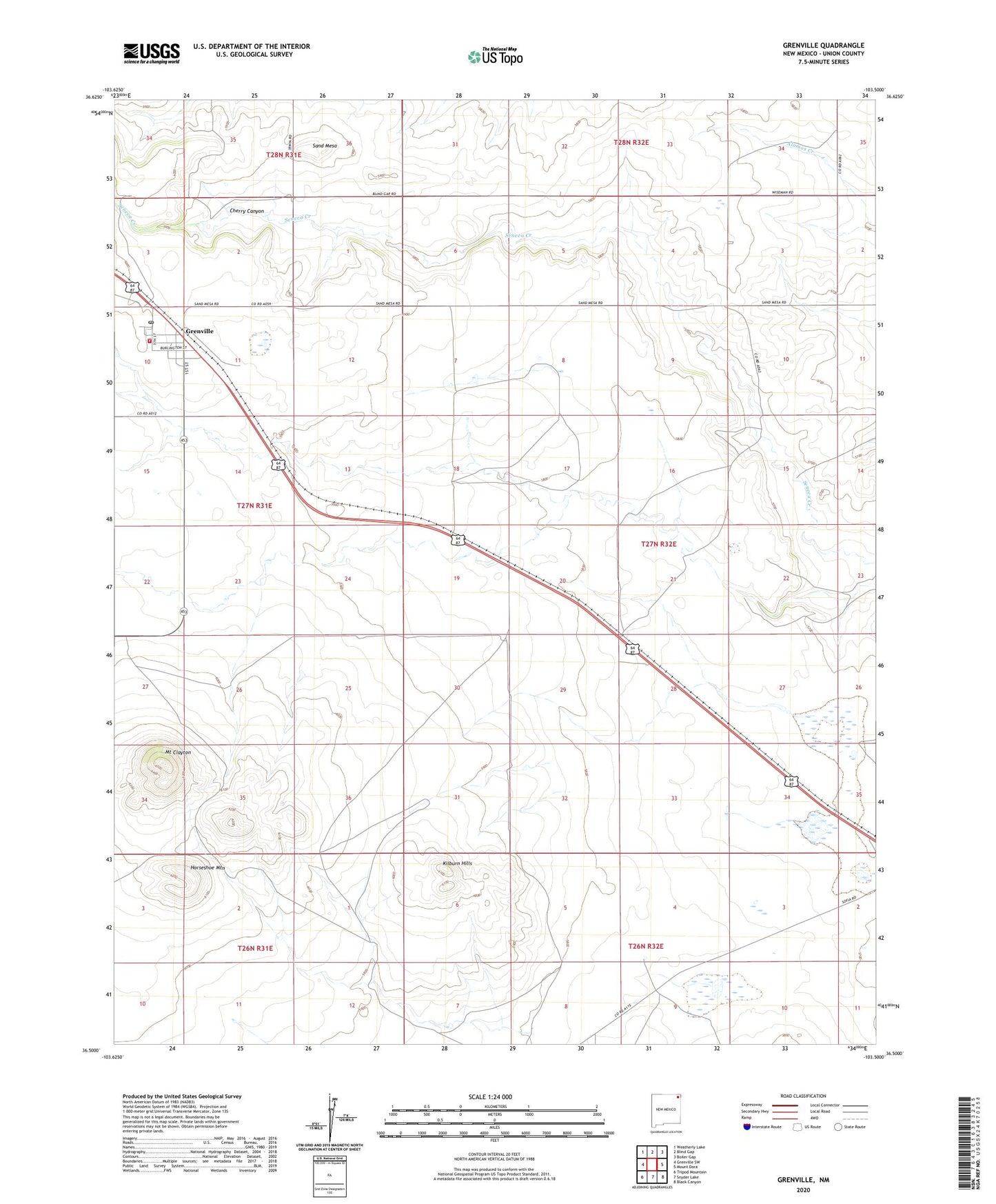
2023 topographic map quadrangle Grenville in the state of New Mexico. Scale: 1:24000. Based on the newly updated USGS 7.5' US Topo map series, this map is in the following counties: Union. The map contains contour data, water features, and other items you are used to seeing on USGS maps, but also has updated roads and other features. This is the next generation of topographic maps. Printed on high-quality waterproof paper with UV fade-resistant inks.
Quads adjacent to this one:
West: Grenville SW
Northwest: Weatherly Lake
North: Blind Gap
Northeast: Boiler Gap
East: Mount Dora
Southeast: Black Canyon
South: Snyder Lake
Southwest: Tripod Mountain
This map covers the same area as the classic USGS quad with code o36103e5.
Contains the following named places: 58 133 F, Cherry Canyon, Grenville, Grenville Cemetery, Grenville Fire Department, Grenville Post Office, Horseshoe Mountain, Kilburn Hills, Marquez, Mount Clayton, Sand Mesa, Seneca Pit, Village of Grenville