MyTopo
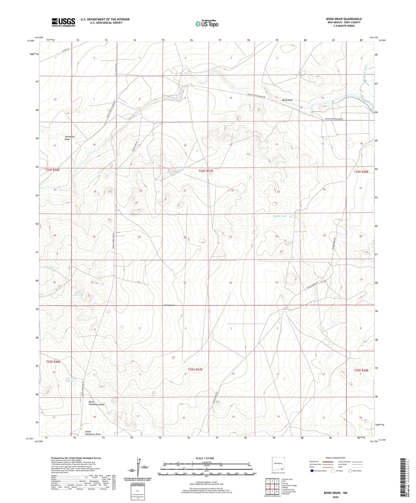
Bond Draw New Mexico US Topo Map
Couldn't load pickup availability
2020 topographic map quadrangle Bond Draw in the state of New Mexico. Scale: 1:24000. Based on the newly updated USGS 7.5' US Topo map series, this map is in the following counties: Eddy. The map contains contour data, water features, and other items you are used to seeing on USGS maps, but also has updated roads and other features. This is the next generation of topographic maps. Printed on high-quality waterproof paper with UV fade-resistant inks.
Quads adjacent to this one:
West: Black River Village
Northwest: Kitchen Cove
North: Otis
Northeast: Loving
East: Malaga
Southeast: Red Bluff
South: Cottonwood Hills
Southwest: Jumping Spring
Contains the following named places: 06619 Water Well, 06620 Water Well, 06626 Water Well, 20057 Water Well, 20060 Water Well, 20074 Water Well, 20075 Water Well, 20079 Water Well, 20080 Water Well, AAA Tank, Beaman Tank, Bond Draw, Bounds Family Cemetery, CCC Tank Number 1, CCC Tank Number 2, Cement Tank Well, Double Tank, Hackberry Well, Harkey Crossing, Harkey Double Mills, John Forehand Ranch, Little AAA Tank, North Hackberry Draw, Northwest Well, Reeves Ranch, Roy Forehand Ranch, South Hackberry Draw, Southeast Well, Threemile Draw