MyTopo
Bonner Lake New Mexico US Topo Map
Couldn't load pickup availability
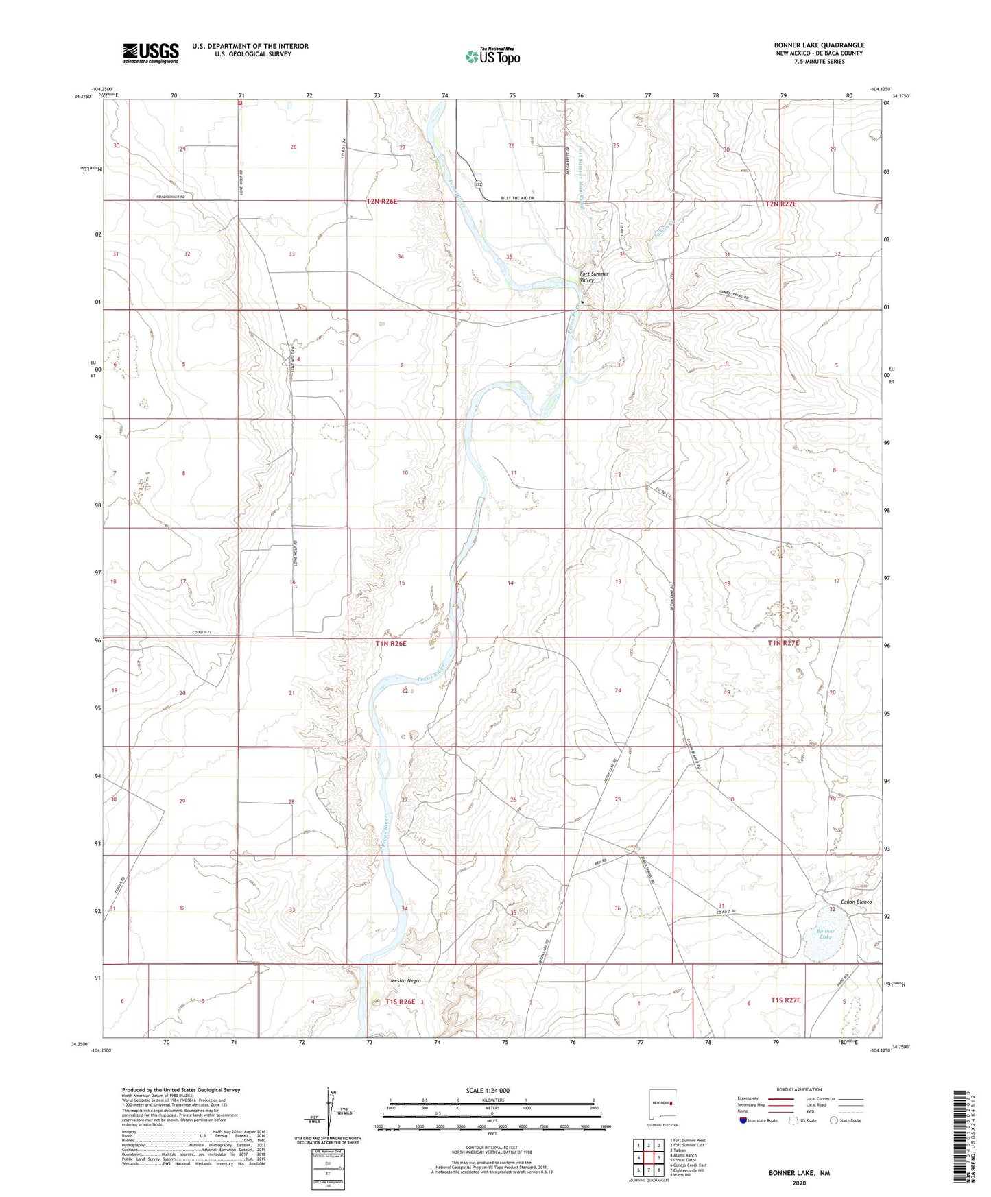
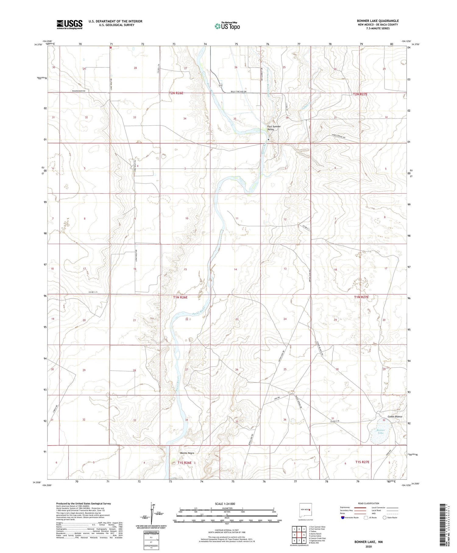
2020 topographic map quadrangle Bonner Lake in the state of New Mexico. Scale: 1:24000. Based on the newly updated USGS 7.5' US Topo map series, this map is in the following counties: De Baca. The map contains contour data, water features, and other items you are used to seeing on USGS maps, but also has updated roads and other features. This is the next generation of topographic maps. Printed on high-quality waterproof paper with UV fade-resistant inks.
Quads adjacent to this one:
West: Alamo Ranch
Northwest: Fort Sumner West
North: Fort Sumner East
Northeast: Taiban
East: Lomas Gatos
Southeast: Watts Hill
South: Eighteenmile Hill
Southwest: Conejo Creek East
Contains the following named places: 10000 Water Well, 10001 Water Well, 10030 Water Well, 10088 Water Well, 10090 Water Well, 10091 Water Well, 10092 Water Well, 10093 Water Well, 10094 Water Well, 10095 Water Well, 10096 Water Well, 10097 Water Well, 10099 Water Well, 10100 Water Well, 10101 Water Well, 10102 Water Well, 10103 Water Well, 10104 Water Well, 10105 Water Well, 10107 Water Well, 10108 Water Well, 10110 Water Well, 10111 Water Well, 10112 Water Well, 10114 Water Well, 10115 Water Well, 10116 Water Well, 10208 Water Well, 10209 Water Well, 10851 Water Well, 20000 Water Well, Bonner Lake, Canon Blanco, Cibolo Creek, East De Baca Division, Fort Sumner Valley, Mesita Negra, Ricardo Volunteer Fire Department, Taiban Creek