MyTopo
Eighteenmile Hill New Mexico US Topo Map
Couldn't load pickup availability
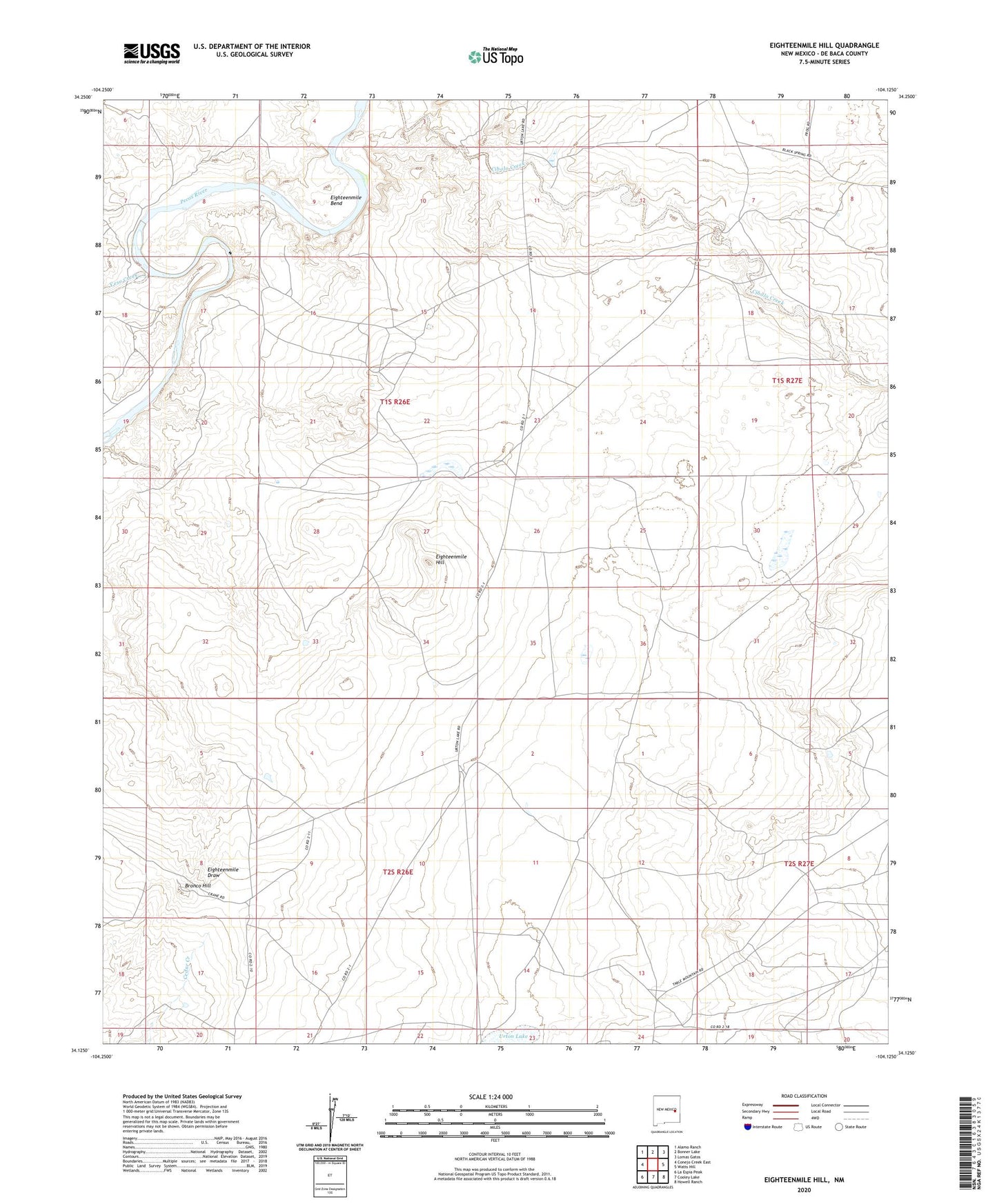
2023 topographic map quadrangle Eighteenmile Hill in the state of New Mexico. Scale: 1:24000. Based on the newly updated USGS 7.5' US Topo map series, this map is in the following counties: De Baca. The map contains contour data, water features, and other items you are used to seeing on USGS maps, but also has updated roads and other features. This is the next generation of topographic maps. Printed on high-quality waterproof paper with UV fade-resistant inks.
Quads adjacent to this one:
West: Conejo Creek East
Northwest: Alamo Ranch
North: Bonner Lake
Northeast: Lomas Gatos
East: Watts Hill
Southeast: Howell Ranch
South: Cooley Lake
Southwest: La Espia Peak
This map covers the same area as the classic USGS quad with code o34104b2.
Contains the following named places: Bronco Hill, Eighteenmile Bend, Eighteenmile Hill, Yeso Creek