MyTopo
Bosque Peak New Mexico US Topo Map
Couldn't load pickup availability
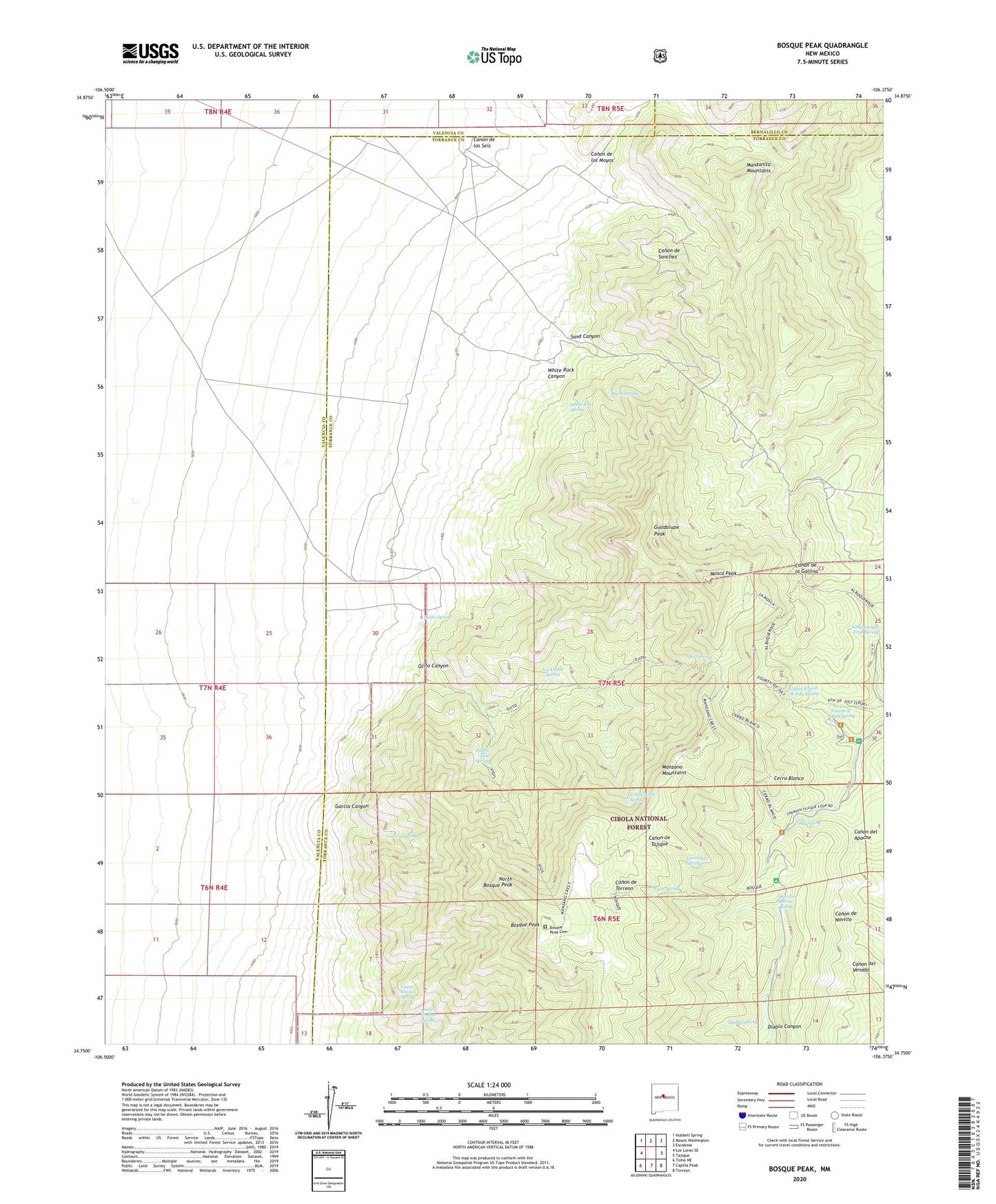
2020 topographic map quadrangle Bosque Peak in the state of New Mexico. Scale: 1:24000. Based on the newly updated USGS 7.5' US Topo map series, this map is in the following counties: Torrance, Valencia, Bernalillo. The map contains contour data, water features, and other items you are used to seeing on USGS maps, but also has updated roads and other features. This is the next generation of topographic maps. Printed on high-quality waterproof paper with UV fade-resistant inks.
Quads adjacent to this one:
West: Los Lunas SE
Northwest: Hubbell Spring
North: Mount Washington
Northeast: Escabosa
East: Tajique
Southeast: Torreon
South: Capilla Peak
Southwest: Tome NE
Contains the following named places: 10029 Water Well, 10241 Water Well, Albuquerque Trail, Albuquerque Trail Spring, Big Spring, Bosque Peak, Bosque Peak Cemetery, Bosque Trail, Bosque Trailhead, Canon de los Moyos, Canon de los Seis, Cave Spring, Cerro Blanco, Cerro Blanco Trail, Cerro Blanco Trailhead, Diablo Canyon, Diablo Spring, Encino Canyon, Escondido Spring, Fourth of July Campground, Fourth of July Spring, Garcia Canyon, Garcia Spring, Guadalupe Peak, Lo De Padilla, Lolito Spring, Los Vayas Spring, Lower Encino Spring, Mosca Peak, Mosca Trail, North Bosque Peak, Ojito Canyon, Ojito Los Burros Spring, Ojito Trail, Piedra Lisa Spring, Pitch Spring, Sand Canyon, Tilio Spring, Upper Encino Spring, Upper Fourth of July Spring, Vigil Trail, White Rock Canyon, White Rock Spring, Yellowstone Spring, Yellowstone Trail