MyTopo
Briscoe Ranch New Mexico US Topo Map
Couldn't load pickup availability
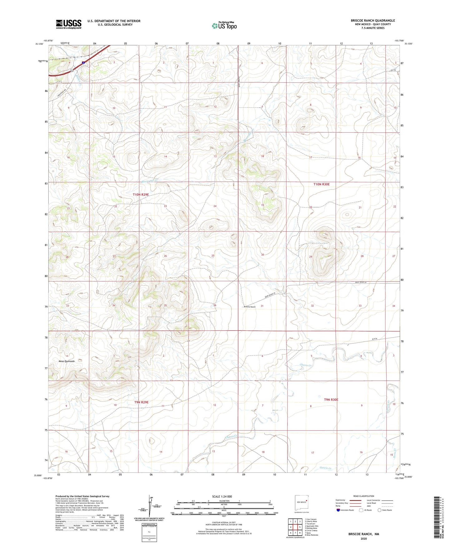
2023 topographic map quadrangle Briscoe Ranch in the state of New Mexico. Scale: 1:24000. Based on the newly updated USGS 7.5' US Topo map series, this map is in the following counties: Quay. The map contains contour data, water features, and other items you are used to seeing on USGS maps, but also has updated roads and other features. This is the next generation of topographic maps. Printed on high-quality waterproof paper with UV fade-resistant inks.
Quads adjacent to this one:
West: Quemado Hills
Northwest: Cow Canyon
North: Liberty Mesa
Northeast: Tucumcari
East: Bulldog Mesa
Southeast: Mesa Redonda
South: Quay
Southwest: Circle S Mesa
This map covers the same area as the classic USGS quad with code o35103a7.
Contains the following named places: 05090 Water Well, 05091 Water Well, 05092 Water Well, 05093 Water Well, 05099 Water Well, 05103 Water Well, 05104 Water Well, 05105 Water Well, 05110 Water Well, 05118 Water Well, 05120 Water Well, 05124 Water Well, 05126 Water Well, 05127 Water Well, 05128 Water Well, 05130 Water Well, 05132 Water Well, 10096 Water Well, 10100 Water Well, 10103 Water Well, 10104 Water Well, 88401, Briscoe Ranch, Jose, Kilgore, Mesa Quemado, Paris Creek, Tucumcari Division