MyTopo
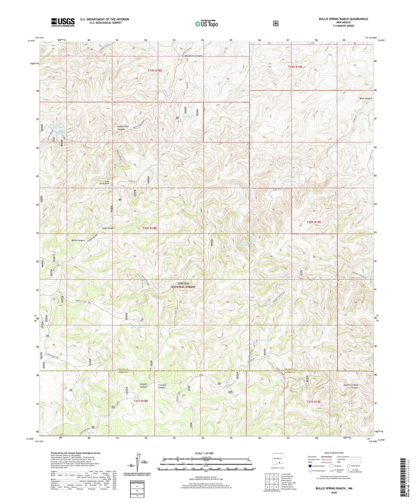
Bullis Spring Ranch New Mexico US Topo Map
Couldn't load pickup availability
Also explore the Bullis Spring Ranch Forest Service Topo of this same quad for updated USFS data
2023 topographic map quadrangle Bullis Spring Ranch in the state of New Mexico. Scale: 1:24000. Based on the newly updated USGS 7.5' US Topo map series, this map is in the following counties: Chaves, Otero. The map contains contour data, water features, and other items you are used to seeing on USGS maps, but also has updated roads and other features. This is the next generation of topographic maps. Printed on high-quality waterproof paper with UV fade-resistant inks.
Quads adjacent to this one:
West: Pinon Ranch
Northwest: Lewis Peak
North: Lewis Peak NE
Northeast: Encino Draw
East: South Taylor Tank
Southeast: Packsaddle Canyon
South: Panama Ranch
Southwest: Tanner Ranch
This map covers the same area as the classic USGS quad with code o32105e1.
Contains the following named places: Buckhorn Canyon, Bullis Spring, Bullis Spring Ranch, Corner Storage Tank, Crip Tank, Crooked Storage Tank, Crooked Well, Dirt Tank, Dry Lake, East Bear Springs, Foster Tank, Foster Water Storage Tank, Indian Trail Canyon, Indian Trail Creek, Indian Water Tank, Lower Long Water Tank, Mean Ranch, New Tank, Prude Ranch, Sargent Seep, South Crooked Canyon, Steve Water Storage Tank, Tammy Water Storage Tank, Terry Ranch, Upper Bear Canyon Water Storage Tank, West Bear Springs, West Crip Water Storage Tank