MyTopo
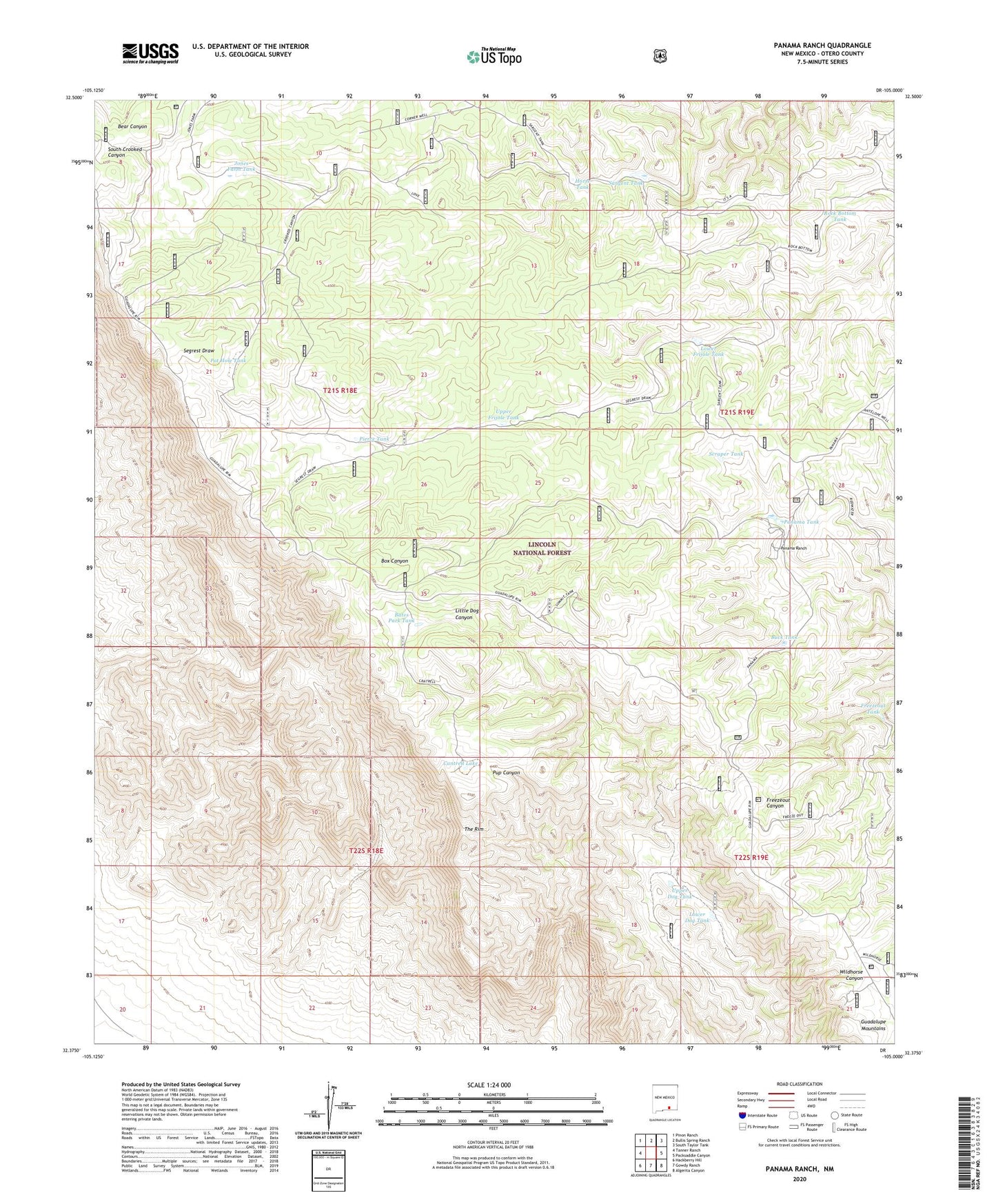
Panama Ranch New Mexico US Topo Map
Couldn't load pickup availability
Also explore the Panama Ranch Forest Service Topo of this same quad for updated USFS data
2023 topographic map quadrangle Panama Ranch in the state of New Mexico. Scale: 1:24000. Based on the newly updated USGS 7.5' US Topo map series, this map is in the following counties: Otero. The map contains contour data, water features, and other items you are used to seeing on USGS maps, but also has updated roads and other features. This is the next generation of topographic maps. Printed on high-quality waterproof paper with UV fade-resistant inks.
Quads adjacent to this one:
West: Tanner Ranch
Northwest: Pinon Ranch
North: Bullis Spring Ranch
Northeast: South Taylor Tank
East: Packsaddle Canyon
Southeast: Algerita Canyon
South: Gowdy Ranch
Southwest: Hackberry Hill
This map covers the same area as the classic USGS quad with code o32105d1.
Contains the following named places: Airplane Water Storage Tank, Bates Park Tank, Buck Tank, Cantrell Lake, Cantrell Water Storage Tank, Corner Water Storage Tank, Corner Well, Crooked WaterStorage Tank, Freezeout Tank, Frijole Water Storage Tank, Horse Tank, Jones Farm Tank, Jones Farm Water Storage Tank, Little Dog Water Storage Tank, Lower Dog Tank, Lower Frijole Tank, Panama Ranch, Panama Tank, Pierce Tank, Pot Hole Tank, Rock Bottom Tank, Sargent Tank, Sargent Water Storage Tank, Sargent Well, Scraper Tank, South Crooked Water Storage Tank, Summit Water Storage Tank, The Rim, Upper Dog Tank, Upper Frijole Tank