MyTopo
Cal Ship Mesa New Mexico US Topo Map
Couldn't load pickup availability
Also explore the Cal Ship Mesa Forest Service Topo of this same quad for updated USFS data
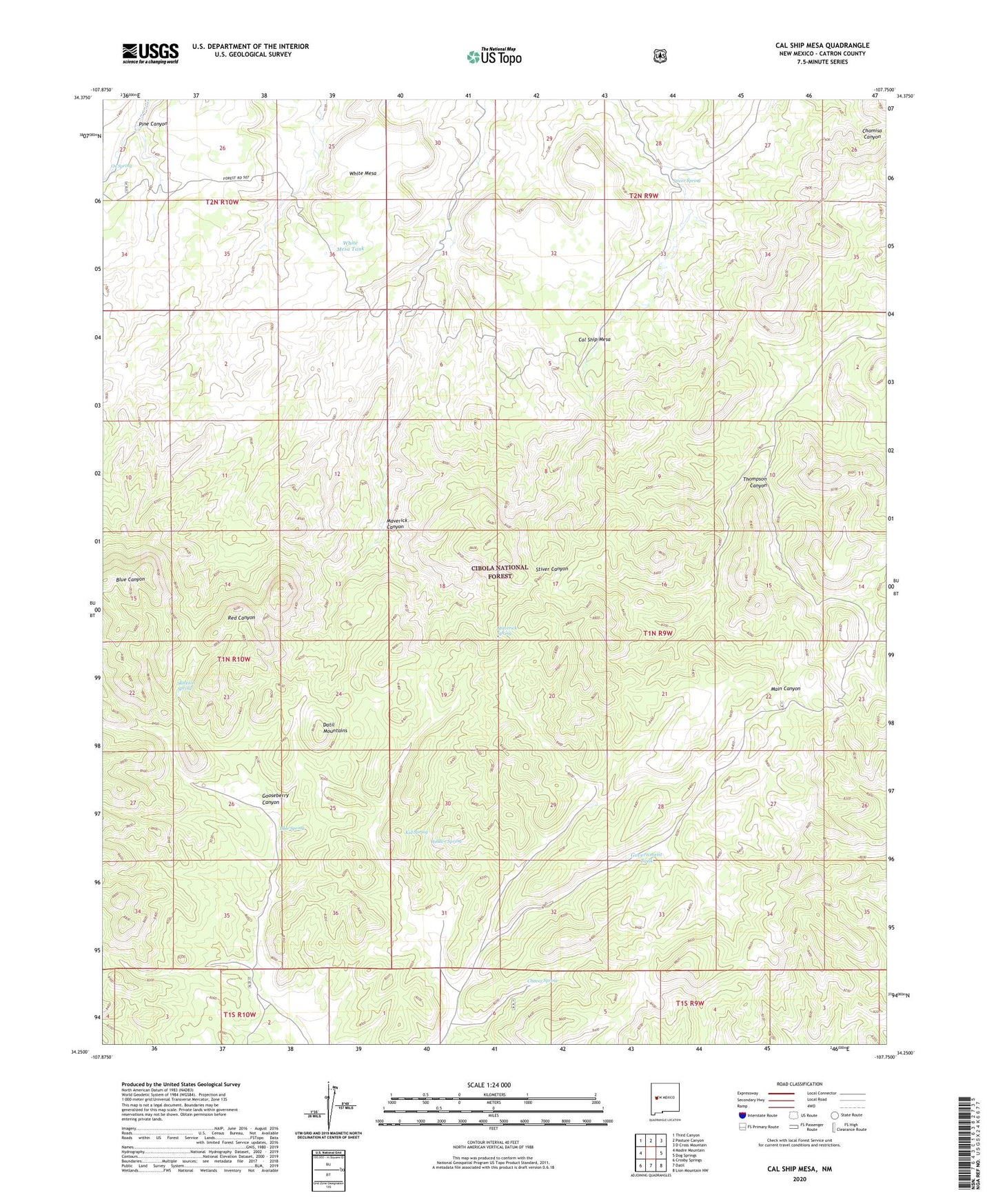
2023 topographic map quadrangle Cal Ship Mesa in the state of New Mexico. Scale: 1:24000. Based on the newly updated USGS 7.5' US Topo map series, this map is in the following counties: Catron. The map contains contour data, water features, and other items you are used to seeing on USGS maps, but also has updated roads and other features. This is the next generation of topographic maps. Printed on high-quality waterproof paper with UV fade-resistant inks.
Quads adjacent to this one:
West: Madre Mountain
Northwest: Third Canyon
North: Pasture Canyon
Northeast: D Cross Mountain
East: Dog Springs
Southeast: Lion Mountain NW
South: Datil
Southwest: Crosby Springs
This map covers the same area as the classic USGS quad with code o34107c7.
Contains the following named places: Alamo Water Well, Antelope Well, Blue Place Well, Blue Spring, Cal Ship Mesa, Chavez Spring, Chinchbug Well, Datil Mountains, Double Tanks Well, Doubletank Water Well, Gooseberry Canyon, Government Tank, Hidden Spring, Kid Spring, Maverick Canyon, Maverick Spring, Ox Spring, Ox Well, Pine Canyon, Pine Well, Remuda Well, Sawhill Windmill, Sawmill Well, Skeleton Spring, Stiver Spring, White Mesa, White Mesa Tank, Williams Tank