MyTopo
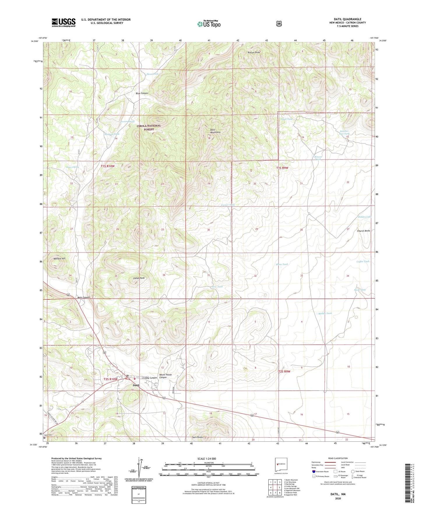
Datil New Mexico US Topo Map
Couldn't load pickup availability
Also explore the Datil Forest Service Topo of this same quad for updated USFS data
2023 topographic map quadrangle Datil in the state of New Mexico. Scale: 1:24000. Based on the newly updated USGS 7.5' US Topo map series, this map is in the following counties: Catron. The map contains contour data, water features, and other items you are used to seeing on USGS maps, but also has updated roads and other features. This is the next generation of topographic maps. Printed on high-quality waterproof paper with UV fade-resistant inks.
Quads adjacent to this one:
West: Crosby Springs
Northwest: Madre Mountain
North: Cal Ship Mesa
Northeast: Dog Springs
East: Lion Mountain NW
Southeast: Augustine Well
South: Anderson Peak
Southwest: Sugarloaf Mountain
This map covers the same area as the classic USGS quad with code o34107b7.
Contains the following named places: Armijo Well, Blue Canyon, Cedar Grove Well, Church Rocks, Clark Tank, Coffee Tank, Cold Water Well, Corner Tank, Crosby Canyon, Daniel Tank, Datil, Datil Baptist Church, Datil Cemetery, Datil Census Designated Place, Datil Elementary School, Datil Emergency Medical Services, Datil Fire Department, Datil Post Office, Datil Water Well, Datil Well Campground, Dean Tank, Double Tanks, Drag A Ranch, Drag A Spring, Eary Ranch, Government Tank Windmill, Hidden Lake, Homestead Windmill, Indian Peak, Jeffers Place, Main Canyon, Medley Well, Middle Tank, New Tank, New Well, Nicol Tank, Norman Spring, Norman Tank, Number Two Tank, Rincon Draw, Rincon Tank, Schuller Well, Shaw Tank, Twin Peaks, Vega Well, Wallace Hill, White House Canyon