MyTopo
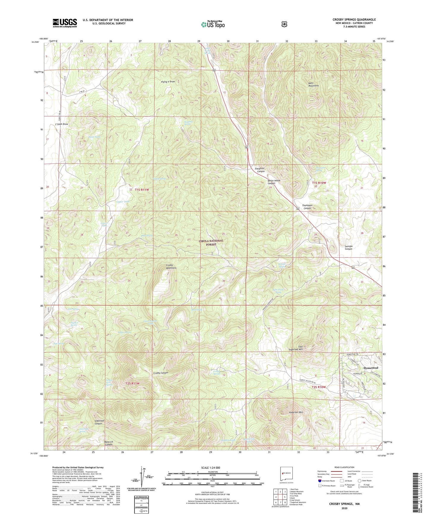
Crosby Springs New Mexico US Topo Map
Couldn't load pickup availability
Also explore the Crosby Springs Forest Service Topo of this same quad for updated USFS data
2023 topographic map quadrangle Crosby Springs in the state of New Mexico. Scale: 1:24000. Based on the newly updated USGS 7.5' US Topo map series, this map is in the following counties: Catron. The map contains contour data, water features, and other items you are used to seeing on USGS maps, but also has updated roads and other features. This is the next generation of topographic maps. Printed on high-quality waterproof paper with UV fade-resistant inks.
Quads adjacent to this one:
West: Cox Peak
Northwest: Red Flats
North: Madre Mountain
Northeast: Cal Ship Mesa
East: Datil
Southeast: Anderson Peak
South: Sugarloaf Mountain
Southwest: Log Canyon
This map covers the same area as the classic USGS quad with code o34107b8.
Contains the following named places: Anderson Mountain, Baldwin Cabin, Baldwin Forest Service Station, Baldwincab Water Well, Buck Water Well, Buck Windmill, Crosby Mountains, Crosby Springs, Deep Tank, Driveway Tank, East Sugarloaf Mountain, Flying V 1A Water Well, Flying V 1B Water Well, Flying V 2 Water Well, Flying V Number 1 Windmill, Flying V Number 2 Windmill, Flying V Spring, Government Tank, Harveys Well, Hidden Spring, Hidden Tank, Home Water Well, Homestead Census Designated Place, Jonnies Well, Lower Tank, Pine Park, Pine Park Tank, Pine Spring, Pipe Spring, Rene Spring, Road Spring, Rock Cliff Tank, Sawmill Well, Slaughter Canyon, Slaughter Spring, Stewart Well, Sugarloaf Spring, Sweeten Windmill, Swingle Canyon, Swingle Spring, Thompson Canyon, Thompson Spring, Turkey Park Spring, Turkey Spring, Upper Tank, Vega Well, White House Spring, White House Well, Whitehouse Water Well, Z Slash Well