MyTopo
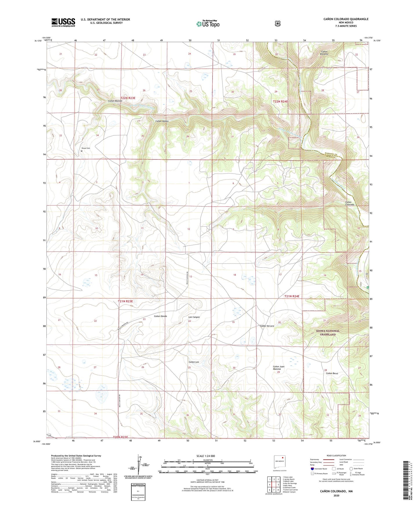
Canon Colorado New Mexico US Topo Map
Couldn't load pickup availability
Also explore the Canon Colorado Forest Service Topo of this same quad for updated USFS data
2023 topographic map quadrangle Canon Colorado in the state of New Mexico. Scale: 1:24000. Based on the newly updated USGS 7.5' US Topo map series, this map is in the following counties: Mora, Harding. The map contains contour data, water features, and other items you are used to seeing on USGS maps, but also has updated roads and other features. This is the next generation of topographic maps. Printed on high-quality waterproof paper with UV fade-resistant inks.
Quads adjacent to this one:
West: Alto De Hormiga
Northwest: Stony Lake
North: Jaritas Ranch
Northeast: Abbott Lake
East: Mills West
Southeast: Beaver Canyon
South: Canon Las Cuevas
Southwest: Alamosa Creek
This map covers the same area as the classic USGS quad with code o36104a4.
Contains the following named places: Arroyo Piedra Lumbre, Canon Biscante, Canon Colorado, Canon Monnet, Canon Valdez, Horn, Kates, Mills Canyon Campground, Mills Canyon Historical Marker, Monroe, Paises Cemetery