MyTopo
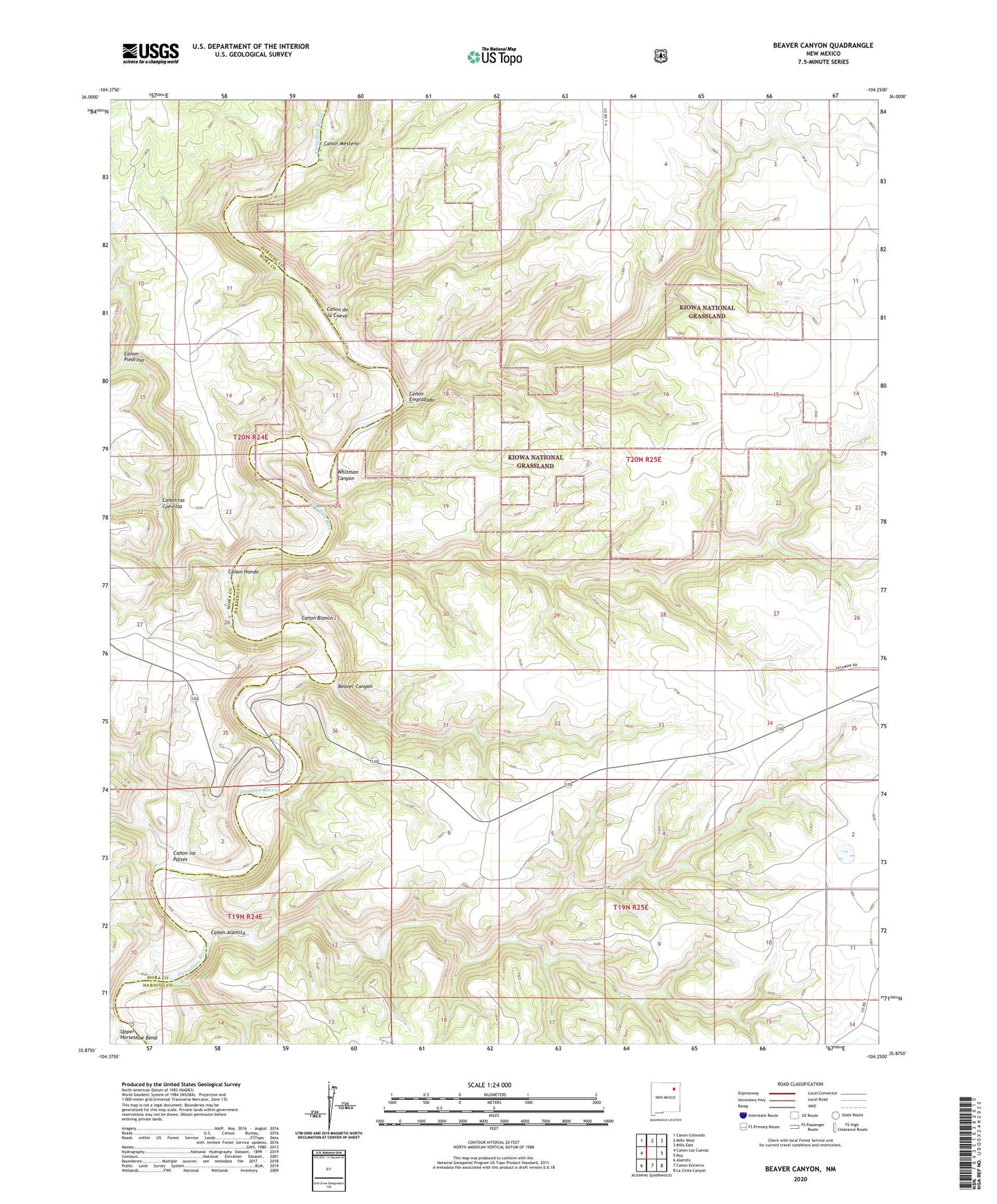
Beaver Canyon New Mexico US Topo Map
Couldn't load pickup availability
Also explore the Beaver Canyon Forest Service Topo of this same quad for updated USFS data
2023 topographic map quadrangle Beaver Canyon in the state of New Mexico. Scale: 1:24000. Based on the newly updated USGS 7.5' US Topo map series, this map is in the following counties: Harding, Mora. The map contains contour data, water features, and other items you are used to seeing on USGS maps, but also has updated roads and other features. This is the next generation of topographic maps. Printed on high-quality waterproof paper with UV fade-resistant inks.
Quads adjacent to this one:
West: Canon Las Cuevas
Northwest: Canon Colorado
North: Mills West
Northeast: Mills East
East: Roy
Southeast: La Cinta Canyon
South: Canon Encierro
Southwest: Alamito
This map covers the same area as the classic USGS quad with code o35104h3.
Contains the following named places: Beaver Canyon, Canon Alamita, Canon Blanco, Canon de la Cueva, Canon Emplazado, Canon Hondo, Canon las Cuevitas, Canon los Paises, Canon Mesteno, Canon Piedroso, Whitman Canyon