MyTopo
Alto De Hormiga New Mexico US Topo Map
Couldn't load pickup availability
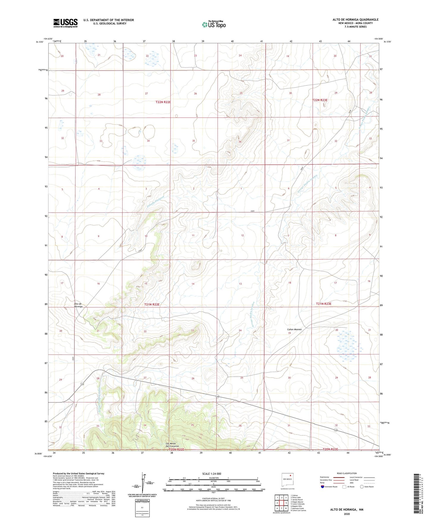
2023 topographic map quadrangle Alto De Hormiga in the state of New Mexico. Scale: 1:24000. Based on the newly updated USGS 7.5' US Topo map series, this map is in the following counties: Mora. The map contains contour data, water features, and other items you are used to seeing on USGS maps, but also has updated roads and other features. This is the next generation of topographic maps. Printed on high-quality waterproof paper with UV fade-resistant inks.
Quads adjacent to this one:
West: Wagon Mound
Northwest: Colmor
North: Stony Lake
Northeast: Jaritas Ranch
East: Canon Colorado
Southeast: Canon Las Cuevas
South: Alamosa Creek
Southwest: Mogote Hills
This map covers the same area as the classic USGS quad with code o36104a5.
Contains the following named places: Alto de Hormiga, Canada Ensinosa, Montoya, Piedra Lumbre Church, Wengert, Wooton and Wooton Ranch