MyTopo
Canoncito School New Mexico US Topo Map
Couldn't load pickup availability
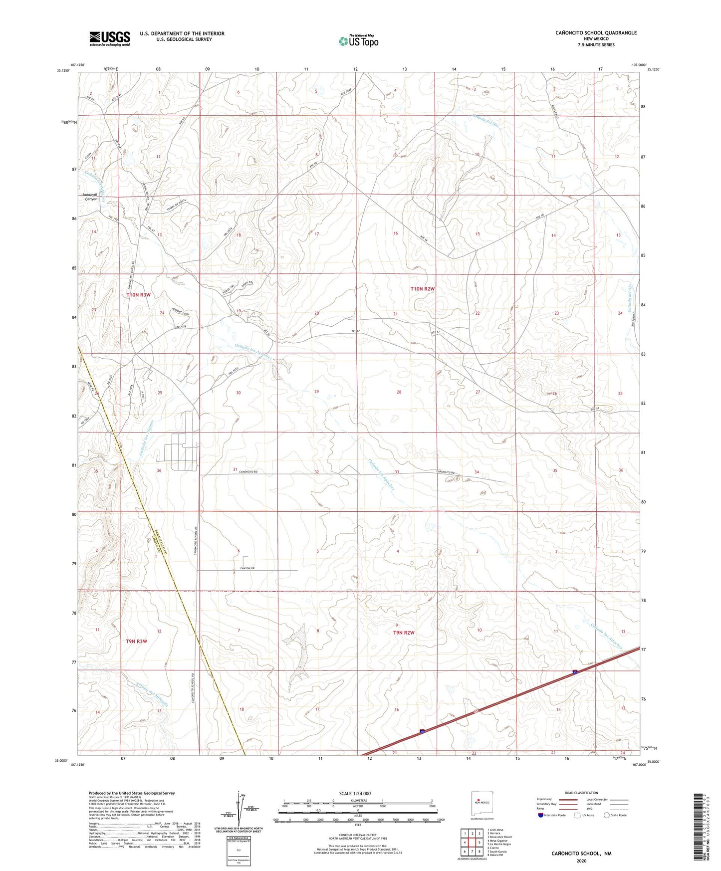
2023 topographic map quadrangle Canoncito School in the state of New Mexico. Scale: 1:24000. Based on the newly updated USGS 7.5' US Topo map series, this map is in the following counties: Bernalillo, Cibola. The map contains contour data, water features, and other items you are used to seeing on USGS maps, but also has updated roads and other features. This is the next generation of topographic maps. Printed on high-quality waterproof paper with UV fade-resistant inks.
Quads adjacent to this one:
West: Mesa Gigante
Northwest: Arch Mesa
North: Herrera
Northeast: Benavidez Ranch
East: La Mesita Negra
Southeast: Dalies NW
South: South Garcia
Southwest: Correo
This map covers the same area as the classic USGS quad with code o35107a1.
Contains the following named places: Canada los Alamos, Canoncito Chapter, Canoncito Mine, Canoncito Navajo Day School, Canoncito Reservation, City of Albuquerque West Mesa Well, Desid Plat Water Well, Ferro Mine, Herrera Ranch, Navajo Nation Emergency Medical Services Tohajiilee, PD and C 5 Water Well, Rio Salado North Detention Dam Number 46, RT-7 Water Well, RWP14 Water Well, RWP4 Water Well, RWP7 Water Well, RWP8 Water Well, Sandoval Canyon