MyTopo
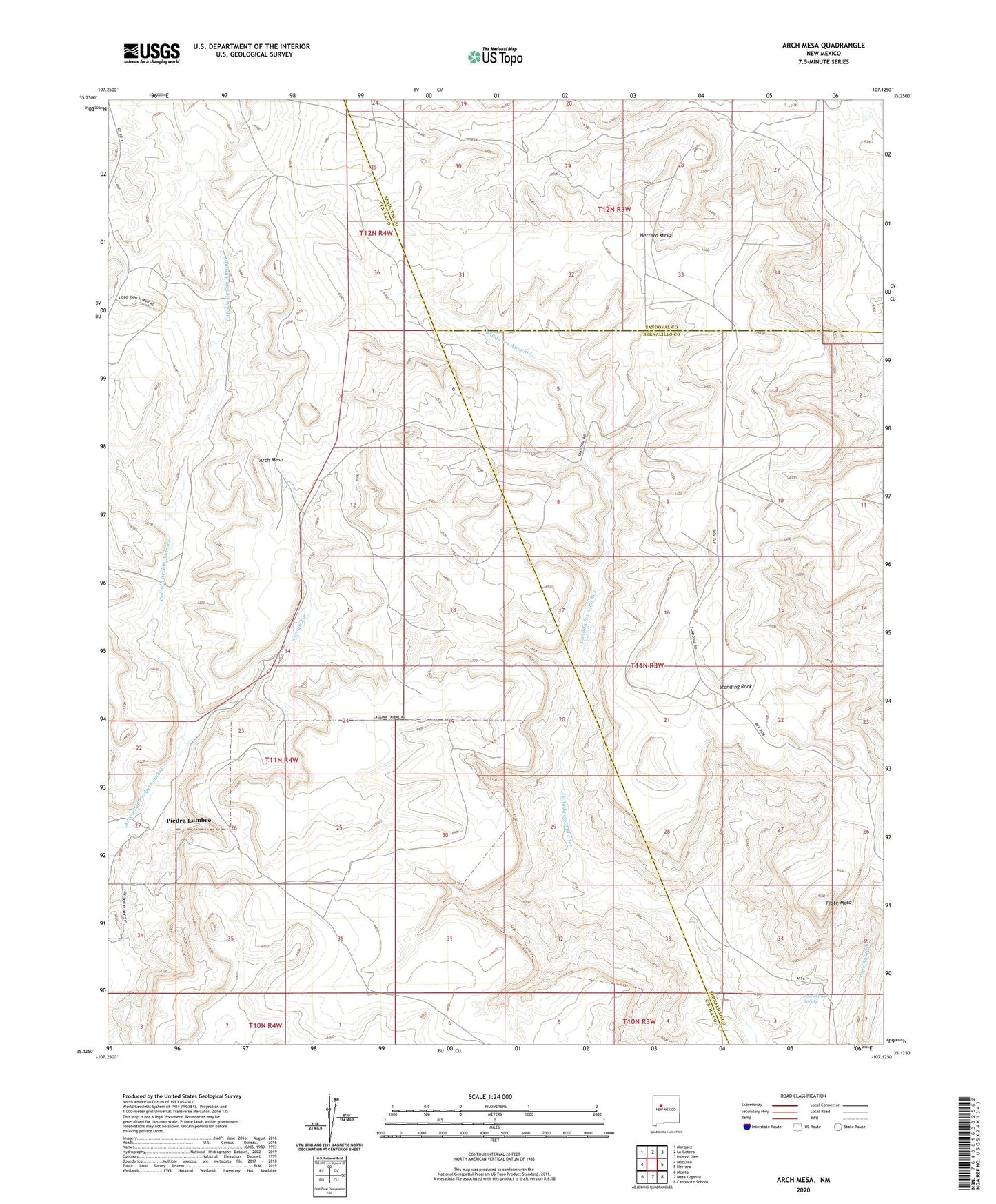
Arch Mesa New Mexico US Topo Map
Couldn't load pickup availability
2023 topographic map quadrangle Arch Mesa in the state of New Mexico. Scale: 1:24000. Based on the newly updated USGS 7.5' US Topo map series, this map is in the following counties: Cibola, Bernalillo, Sandoval. The map contains contour data, water features, and other items you are used to seeing on USGS maps, but also has updated roads and other features. This is the next generation of topographic maps. Printed on high-quality waterproof paper with UV fade-resistant inks.
Quads adjacent to this one:
West: Moquino
Northwest: Marquez
North: La Gotera
Northeast: Puerco Dam
East: Herrera
Southeast: Canoncito School
South: Mesa Gigante
Southwest: Mesita
This map covers the same area as the classic USGS quad with code o35107b2.
Contains the following named places: Arch Mesa, Arroyo Zia, Canada de San Antonio, Canoncito 5 Water Well, Hackberry Windmill, Herrera Mesa, Herrera Mesa Windmill, Jose Manuel Spring, Meyer Water Well, Meyer Windmill, Number 61 Water Well, Piedra Lumbre, Plate Mesa, RWP12 Water Well, RWP5 Water Well, Seboyeta Irrigation System Dam, Seboyeta Reservoir, Standing Rock