MyTopo
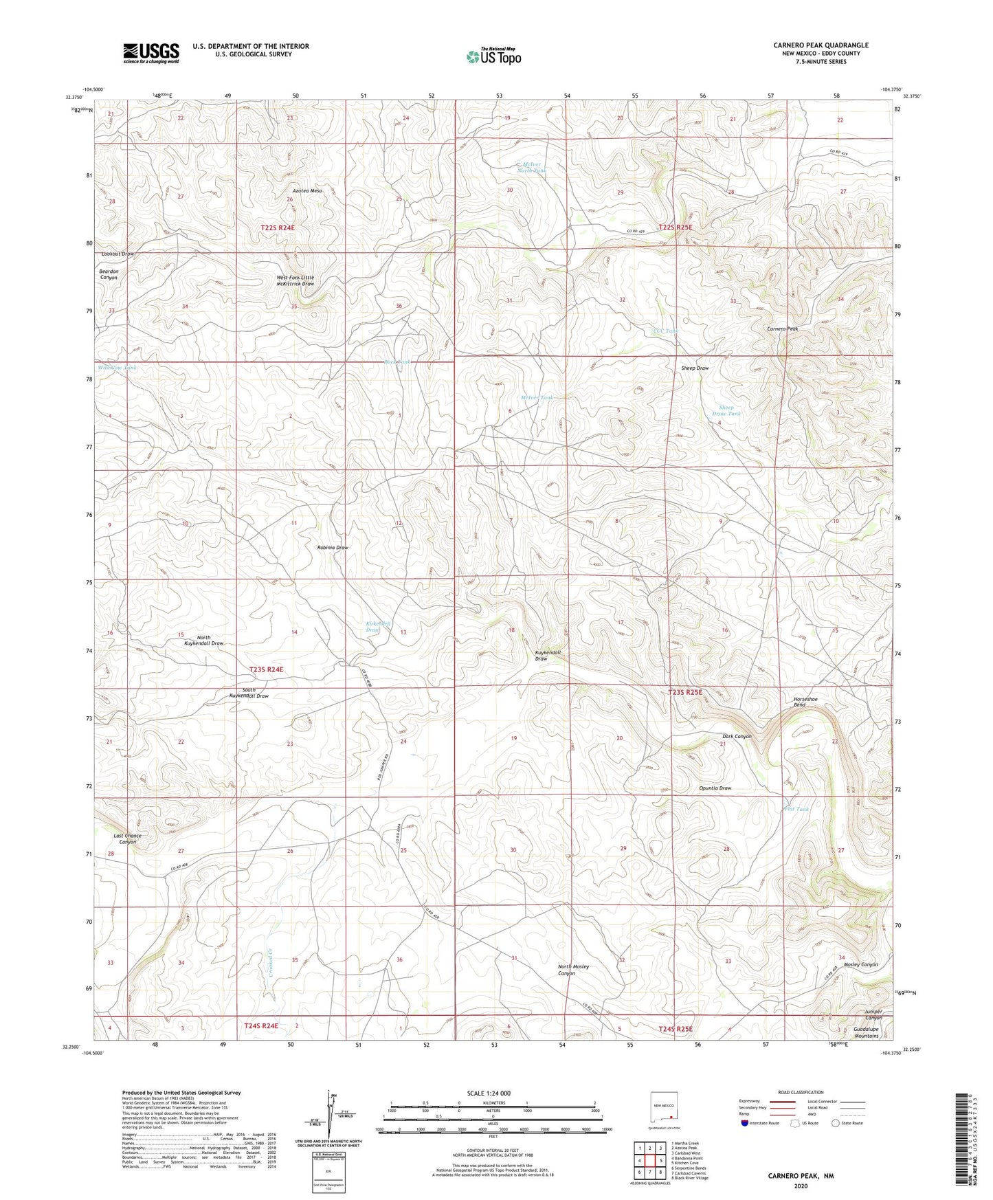
Carnero Peak New Mexico US Topo Map
Couldn't load pickup availability
2020 topographic map quadrangle Carnero Peak in the state of New Mexico. Scale: 1:24000. Based on the newly updated USGS 7.5' US Topo map series, this map is in the following counties: Eddy. The map contains contour data, water features, and other items you are used to seeing on USGS maps, but also has updated roads and other features. This is the next generation of topographic maps. Printed on high-quality waterproof paper with UV fade-resistant inks.
Quads adjacent to this one:
West: Bandanna Point
Northwest: Martha Creek
North: Azotea Peak
Northeast: Carlsbad West
East: Kitchen Cove
Southeast: Black River Village
South: Carlsbad Caverns
Southwest: Serpentine Bends
Contains the following named places: Beardon Canyon, Beardon Well, Carlsbad Division, Carnero Peak, CCC Tank, Crooked Creek, Flat Tank, Gerry Smith Ranch, Hackberry Tank, Horseshoe Bend, Kee Ranch, Kirkendell Draw, Kuykendall Draw, Last Chance Canyon, Lookout Draw, McIver North Tank, McIver Ranch, McIver Tank, North Kuykendall Draw, Opuntia Draw, Robinia Draw, Rock Tank, Sheep Draw Tank, Sheep Draw Well, Smith Ranch, Smith Waterhole, South Kuykendall Draw, Truitt Ranch, Truitt Well, Wild Cow Tank, ZIP Code: 88220