MyTopo
Bandanna Point New Mexico US Topo Map
Couldn't load pickup availability
Also explore the Bandanna Point Forest Service Topo of this same quad for updated USFS data
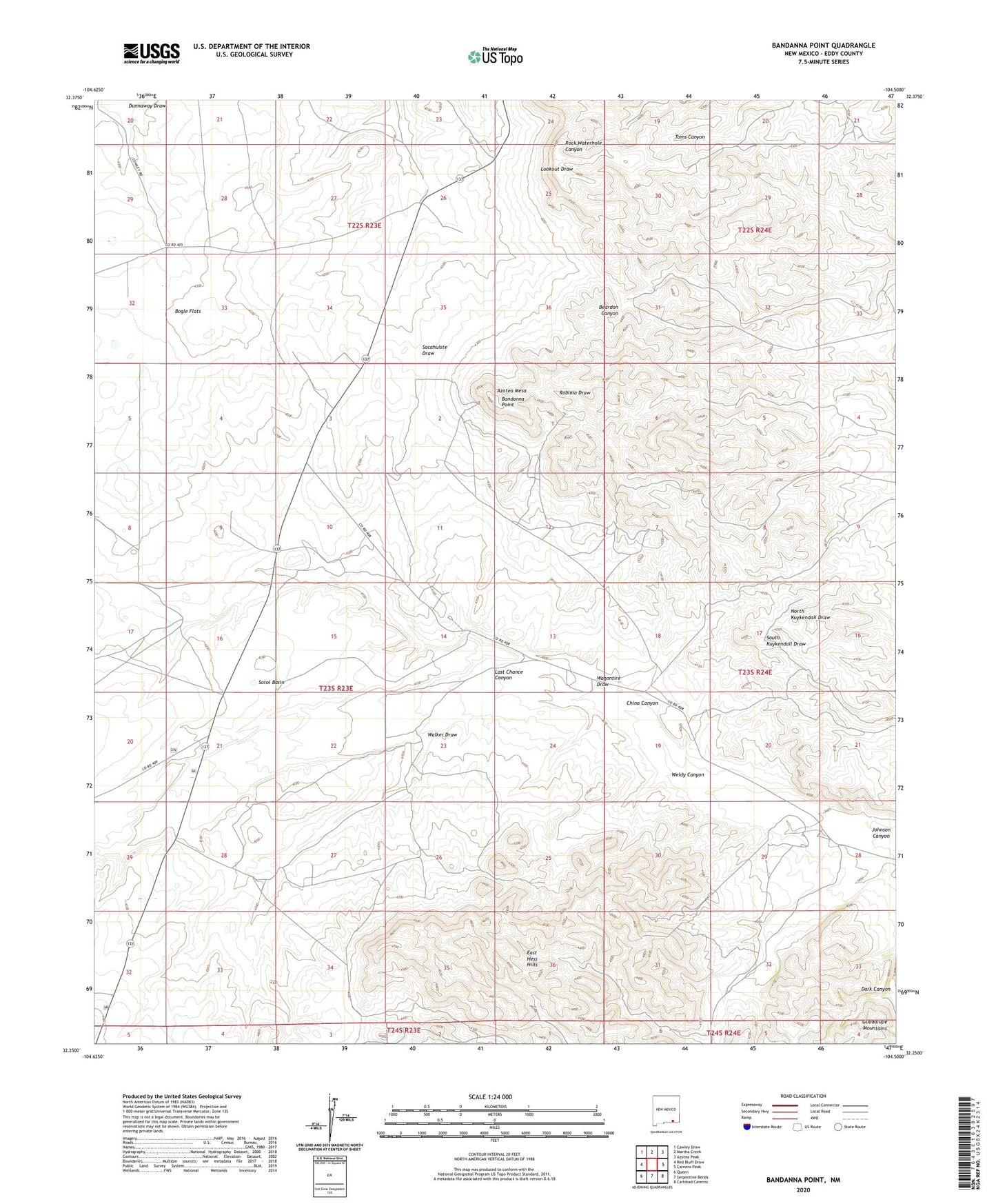
2023 topographic map quadrangle Bandanna Point in the state of New Mexico. Scale: 1:24000. Based on the newly updated USGS 7.5' US Topo map series, this map is in the following counties: Eddy. The map contains contour data, water features, and other items you are used to seeing on USGS maps, but also has updated roads and other features. This is the next generation of topographic maps. Printed on high-quality waterproof paper with UV fade-resistant inks.
Quads adjacent to this one:
West: Red Bluff Draw
Northwest: Cawley Draw
North: Martha Creek
Northeast: Azotea Peak
East: Carnero Peak
Southeast: Carlsbad Caverns
South: Serpentine Bends
Southwest: Queen
This map covers the same area as the classic USGS quad with code o32104c5.
Contains the following named places: 07011 Water Well, 20098 Water Well, 20099 Water Well, 20100 Water Well, 20101 Water Well, 20102 Water Well, 20103 Water Well, 20138 Water Well, 20139 Water Well, 20146 Water Well, 20147 Water Well, Azotea Mesa, Bandanna Point, Callaway Ranch, Callaway Well, China Canyon, East Hess Hills, Johnson Canyon, Lower John Well, Moss Ranch, Pipkin Ranch, Pipkin Well, Russell Ranch, S S Well, Sotol Basin, Wagontire Draw, Walker Draw, Ward Ranch, Weldy Canyon, Weldy Well, Wooten Ranch