MyTopo
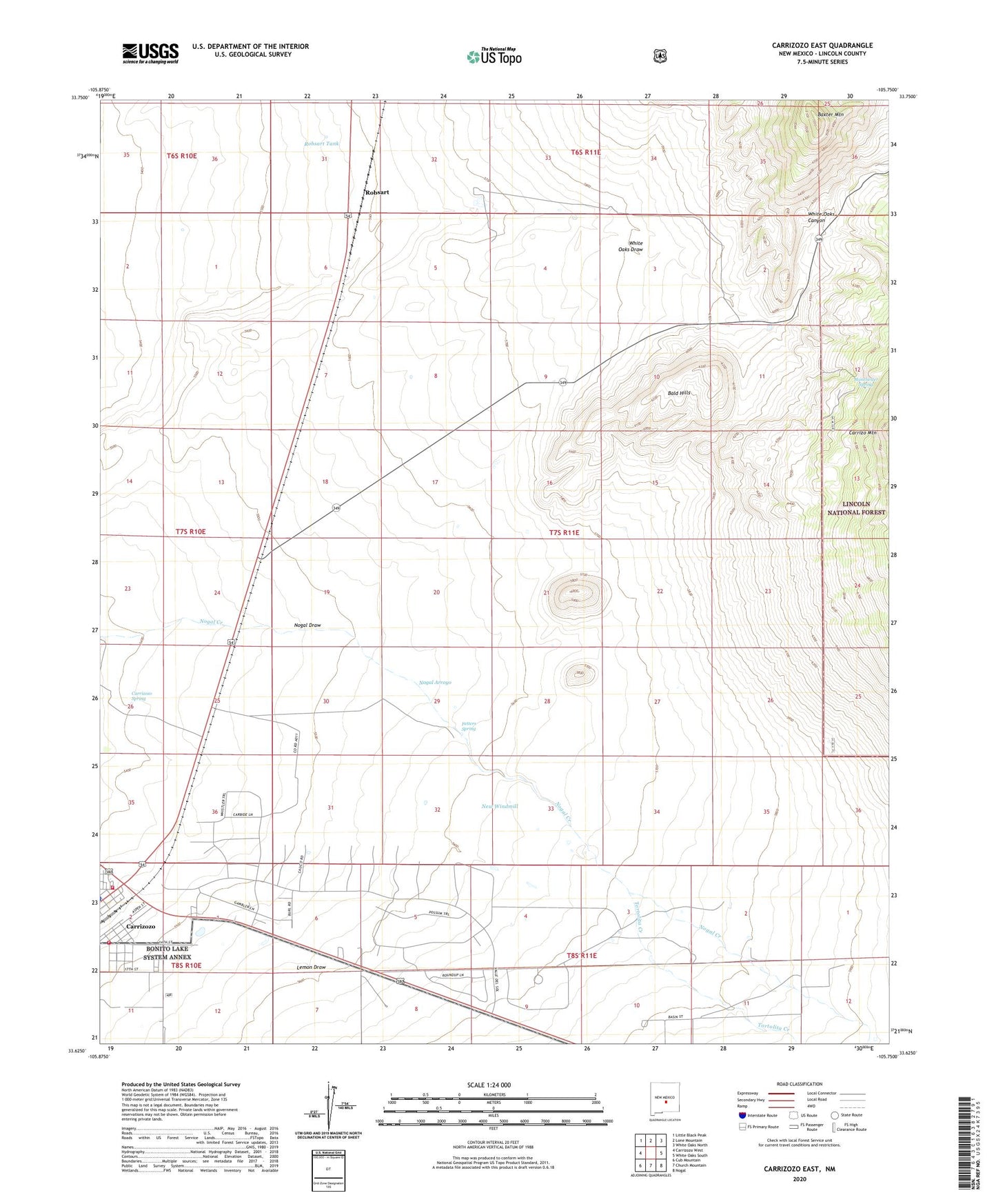
Carrizozo East New Mexico US Topo Map
Couldn't load pickup availability
Also explore the Carrizozo East Forest Service Topo of this same quad for updated USFS data
2023 topographic map quadrangle Carrizozo East in the state of New Mexico. Scale: 1:24000. Based on the newly updated USGS 7.5' US Topo map series, this map is in the following counties: Lincoln. The map contains contour data, water features, and other items you are used to seeing on USGS maps, but also has updated roads and other features. This is the next generation of topographic maps. Printed on high-quality waterproof paper with UV fade-resistant inks.
Quads adjacent to this one:
West: Carrizozo West
Northwest: Little Black Peak
North: Lone Mountain
Northeast: White Oaks North
East: White Oaks South
Southeast: Nogal
South: Church Mountain
Southwest: Cub Mountain
This map covers the same area as the classic USGS quad with code o33105f7.
Contains the following named places: Annie Cade Mine, Bald Hills, Bald Tank, Baxter Mountain, Carrizozo Fire Department, Carrizozo Plant, Carrizozo Spring, Carrizozo Volunteer Fire Department, Collier Mine, Cristopher, Dark Canyon, Dugger Well, Fetters Spring, Forgotten, Gallegos Windmill, Gregory Mine, Homestake South, Lemon Draw, Little Windmill, Lovelace Plant, Luckless, Manchester, Manchester Post Office, Manchester Spring, Mayer Windmill, Middle Windmill, Moss Windmill, New Windmill, Nickles Windmill, Nogal Arroyo, Nogal Creek, Omega Mine, Roberts Windmill, Robsart, Robsart Tank, Round Tank, Southwest Mineral Corp Mill, Spencer, Town of Carrizozo, Twin Tank, White Oaks Canyon, Yucca Windmill