MyTopo
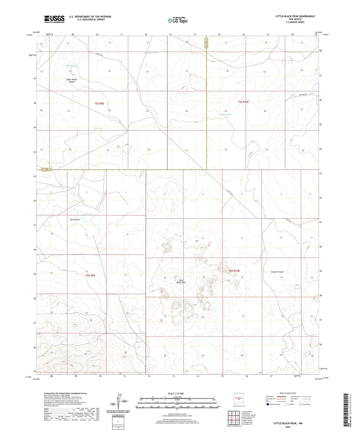
Little Black Peak New Mexico US Topo Map
Couldn't load pickup availability
Also explore the Little Black Peak Forest Service Topo of this same quad for updated USFS data
2023 topographic map quadrangle Little Black Peak in the state of New Mexico. Scale: 1:24000. Based on the newly updated USGS 7.5' US Topo map series, this map is in the following counties: Lincoln, Socorro. The map contains contour data, water features, and other items you are used to seeing on USGS maps, but also has updated roads and other features. This is the next generation of topographic maps. Printed on high-quality waterproof paper with UV fade-resistant inks.
Quads adjacent to this one:
West: Broken Back Crater
Northwest: Lovelace Mesa
North: Dulce Draw
Northeast: Little Black Peak NE
East: Lone Mountain
Southeast: Carrizozo East
South: Carrizozo West
Southwest: Wagon Canyon
This map covers the same area as the classic USGS quad with code o33105g8.
Contains the following named places: 10001 Water Well, Ashbey Tank, Big Tank, Billy Bob Tank, Duck Lake, Farm Windmill, Galcher Ranch, Grumble Tank, Harvey Draw, Little Black Peak, Little Black Peak/Carrizozo Lava Flow Wilderness Study Area, Malpais Windmill, Red Lake, Red Lake Windmill, Red Windmill, Rock Tank, Serno Draw, South Tank, Upper Ranch Canyon