MyTopo
Casa Colorada New Mexico US Topo Map
Couldn't load pickup availability
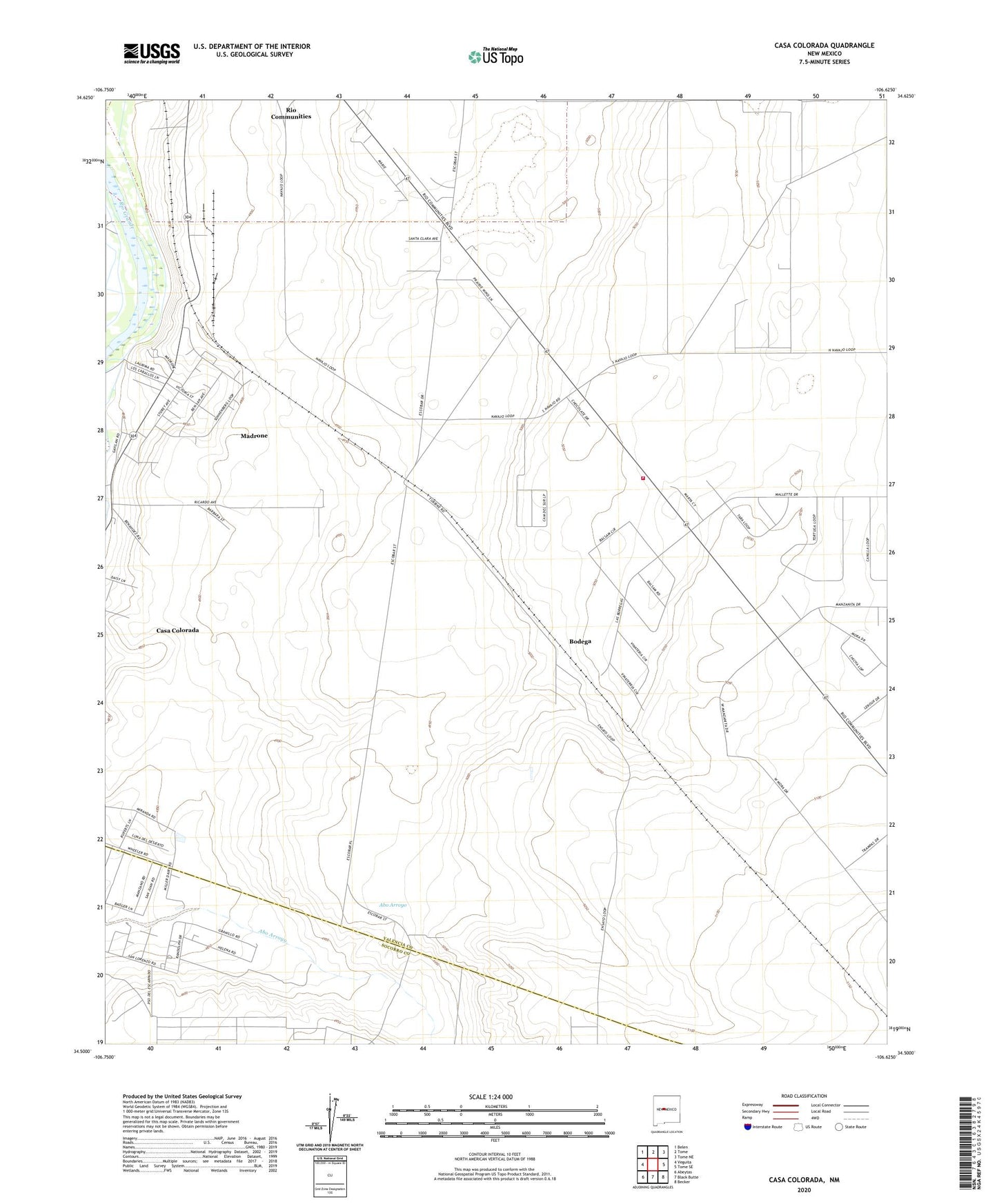
2020 topographic map quadrangle Casa Colorada in the state of New Mexico. Scale: 1:24000. Based on the newly updated USGS 7.5' US Topo map series, this map is in the following counties: Valencia, Socorro. The map contains contour data, water features, and other items you are used to seeing on USGS maps, but also has updated roads and other features. This is the next generation of topographic maps. Printed on high-quality waterproof paper with UV fade-resistant inks.
Quads adjacent to this one:
West: Veguita
Northwest: Belen
North: Tome
Northeast: Tome NE
East: Tome SE
Southeast: Becker
South: Black Butte
Southwest: Abeytas
Contains the following named places: Bodega, Casa Colorada, Casa Colorada Census Designated Place, Casa Colorada School, El Paso Natural Gas Turbin Station, Madrone, Madrone Census Designated Place, Madrone Post Office, Pueblo Casa Colorada Historic Site, RG-28525 Water Well, RG-39221 Water Well, Rio Grande Estates Fire and Rescue Teri Grande Substation, San Juan Heading, Turn Post Office, UN 1 Lot 1 Water Well, ZIP Code: 87002