MyTopo
Becker New Mexico US Topo Map
Couldn't load pickup availability
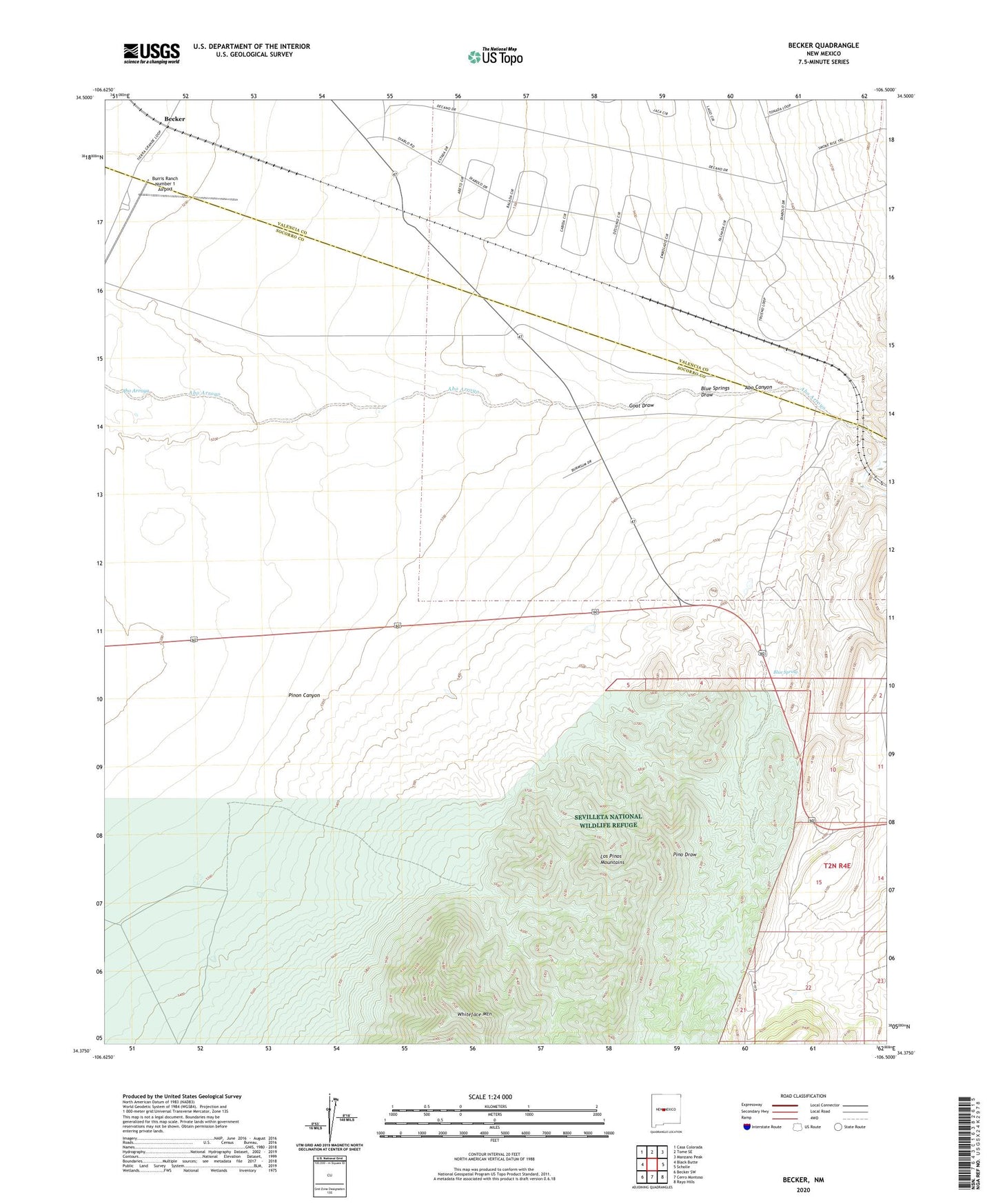
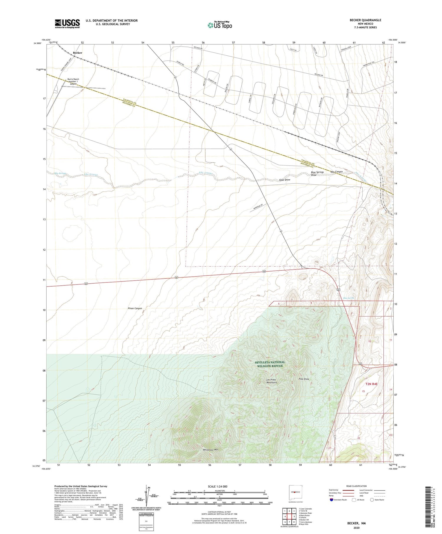
2023 topographic map quadrangle Becker in the state of New Mexico. Scale: 1:24000. Based on the newly updated USGS 7.5' US Topo map series, this map is in the following counties: Socorro, Valencia. The map contains contour data, water features, and other items you are used to seeing on USGS maps, but also has updated roads and other features. This is the next generation of topographic maps. Printed on high-quality waterproof paper with UV fade-resistant inks.
Quads adjacent to this one:
West: Black Butte
Northwest: Casa Colorada
North: Tome SE
Northeast: Manzano Peak
East: Scholle
Southeast: Rayo Hills
South: Cerro Montoso
Southwest: Becker SW
This map covers the same area as the classic USGS quad with code o34106d5.
Contains the following named places: 10019 Water Well, Abo Canyon, Becker, Becker Coal Elevator, Blue Spring, Blue Springs, Blue Springs Draw, Blue Springs Quarry, Burris Ranch Number 1 Airport, Goat Draw, Goat Ranch, Pinon Canyon, Sais, West and Pyle Ranch, Whiteface Mountain