MyTopo
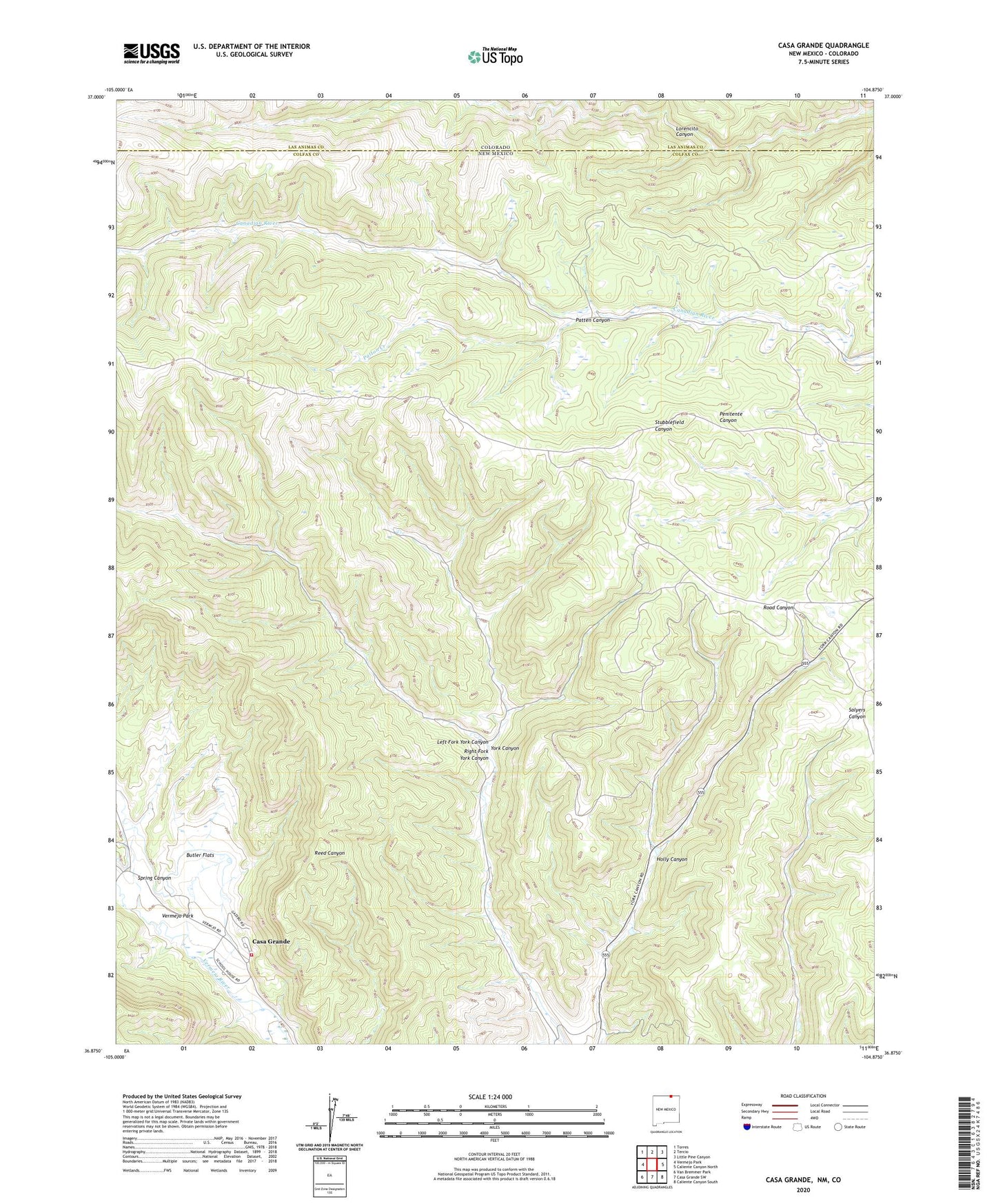
Casa Grande New Mexico US Topo Map
Couldn't load pickup availability
2023 topographic map quadrangle Casa Grande in the state of New Mexico. Scale: 1:24000. Based on the newly updated USGS 7.5' US Topo map series, this map is in the following counties: Colfax, Las Animas. The map contains contour data, water features, and other items you are used to seeing on USGS maps, but also has updated roads and other features. This is the next generation of topographic maps. Printed on high-quality waterproof paper with UV fade-resistant inks.
Quads adjacent to this one:
West: Vermejo Park
Northwest: Torres
North: Tercio
Northeast: Little Pine Canyon
East: Caliente Canyon North
Southeast: Caliente Canyon South
South: Casa Grande SW
Southwest: Van Bremmer Park
This map covers the same area as the classic USGS quad with code o36104h8.
Contains the following named places: Butler Flats, Casa Grande, Casa Grande Post Office, Colfax County Fire Department District 7 Vermejo Park Ranch, Holly Canyon, Kaiser Plant, Kaiser Steel, Left Fork York Canyon, Patten Canyon, Patton Creek, Right Fork York Canyon, Spring Canyon, Vermejo Park, Vermejo Park Ranch Cemetery, West York Canyon, West York Strip, York Canyon Number 1, York Canyon Prospect