MyTopo
Cerro Vista New Mexico US Topo Map
Couldn't load pickup availability
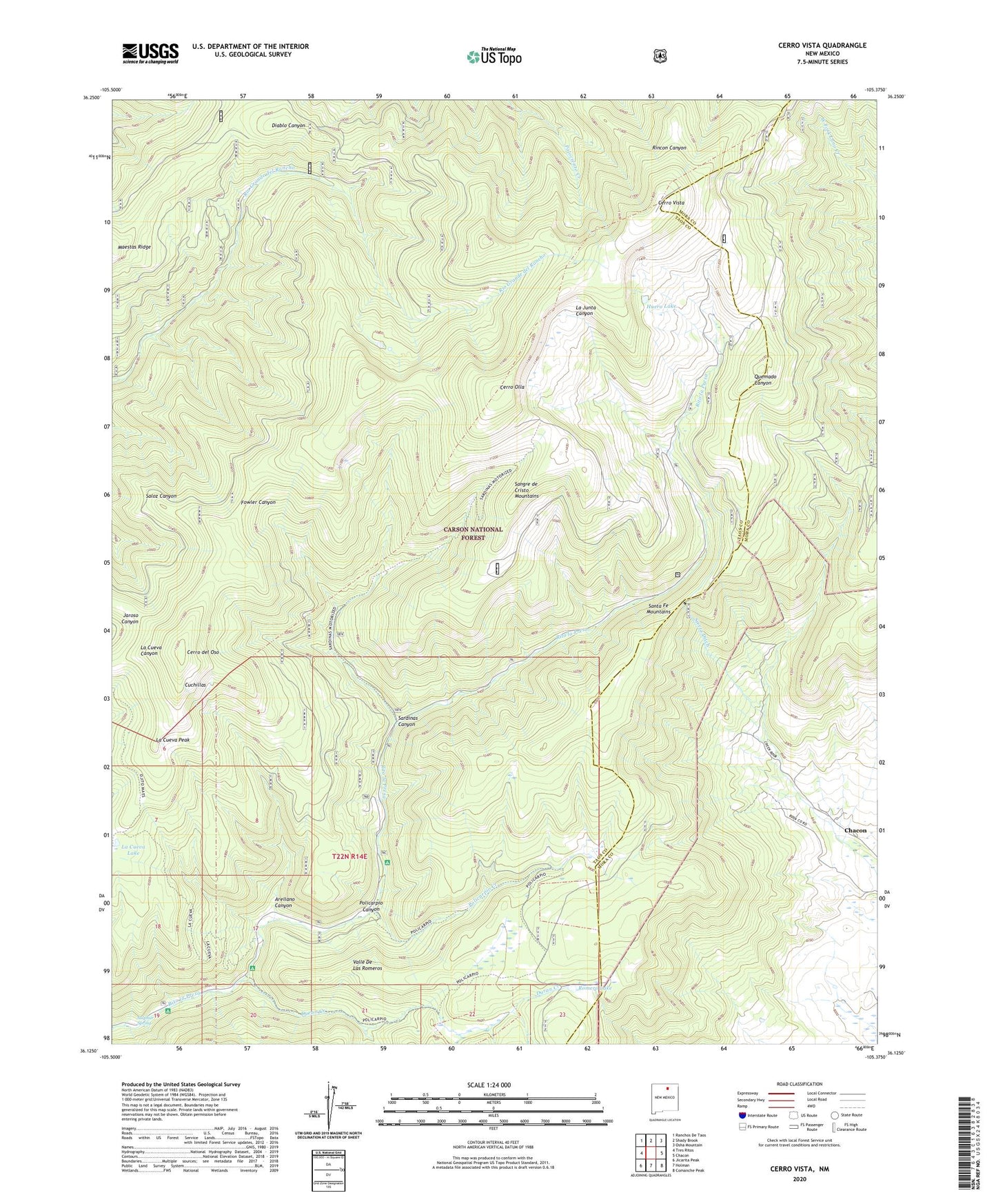
2020 topographic map quadrangle Cerro Vista in the state of New Mexico. Scale: 1:24000. Based on the newly updated USGS 7.5' US Topo map series, this map is in the following counties: Taos, Mora. The map contains contour data, water features, and other items you are used to seeing on USGS maps, but also has updated roads and other features. This is the next generation of topographic maps. Printed on high-quality waterproof paper with UV fade-resistant inks.
Quads adjacent to this one:
West: Tres Ritos
Northwest: Ranchos De Taos
North: Shady Brook
Northeast: Osha Mountain
East: Chacon
Southeast: Comanche Peak
South: Holman
Southwest: Jicarita Peak
Contains the following named places: Arellano Canyon, Cerro del Oso, Cerro Olla, Cerro Vista, Cuchillas, Duran Canyon Campground, Duran Creek, Huero Lake, La Cueva Lake, La Cueva Peak, La Junta Summerhome Area, Little Korea, Policarpio Canyon, Policarpio Creek, Romero Lake, Sardinas Canyon, Sierra Ditch, Sulphur Spring, Upper La Junta Campground, Valle De Las Romeros