MyTopo
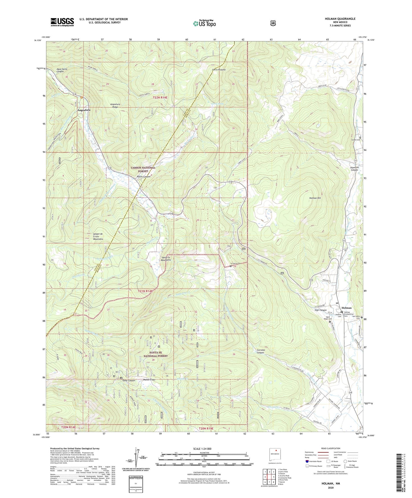
Holman New Mexico US Topo Map
Couldn't load pickup availability
Also explore the Holman Forest Service Topo of this same quad for updated USFS data
2023 topographic map quadrangle Holman in the state of New Mexico. Scale: 1:24000. Based on the newly updated USGS 7.5' US Topo map series, this map is in the following counties: Mora, Taos. The map contains contour data, water features, and other items you are used to seeing on USGS maps, but also has updated roads and other features. This is the next generation of topographic maps. Printed on high-quality waterproof paper with UV fade-resistant inks.
Quads adjacent to this one:
West: Jicarita Peak
Northwest: Tres Ritos
North: Cerro Vista
Northeast: Chacon
East: Comanche Peak
Southeast: Mora
South: Gascon
Southwest: Pecos Falls
This map covers the same area as the classic USGS quad with code o36105a4.
Contains the following named places: Agua Fria Creek, Agua Negra Cemetery, Agua Negra Post Office, Agua Sarca Canyon, Alamitos Canyon, Alamitos Creek, Angostura, Angostura Ridge, Canada de Don Samuel, Canoncito Creek, Cerro Picacho, Corrales Canyon, Holman, Holman Cemetery, Holman Hill, Holman Post Office, Holman Presbyterian Cemetery, Knob Creek, La Canada de los Maes, La Sierra Cemetery, La Sierra Ditch, Las Lagunas, Limestone Quarry, Loring Spring, Lovato Cemetery, Mora Valley Clinic, Osha Canyon, Raton Canyon, Rito Angostura, San Isidro Cemetery, Vega del Estillero, Vigil Canyon, Walker Flats, ZIP Codes: 87715, 87723