MyTopo
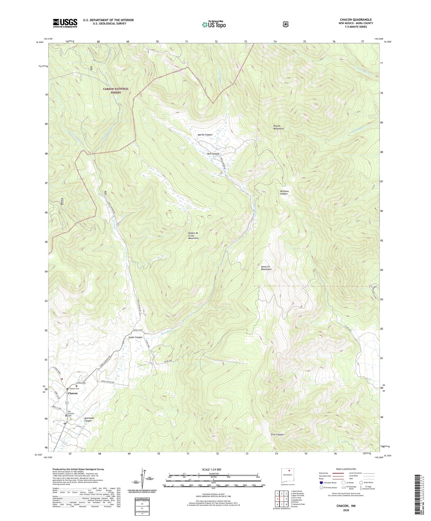
Chacon New Mexico US Topo Map
Couldn't load pickup availability
Also explore the Chacon Forest Service Topo of this same quad for updated USFS data
2023 topographic map quadrangle Chacon in the state of New Mexico. Scale: 1:24000. Based on the newly updated USGS 7.5' US Topo map series, this map is in the following counties: Mora. The map contains contour data, water features, and other items you are used to seeing on USGS maps, but also has updated roads and other features. This is the next generation of topographic maps. Printed on high-quality waterproof paper with UV fade-resistant inks.
Quads adjacent to this one:
West: Cerro Vista
Northwest: Shady Brook
North: Osha Mountain
Northeast: Agua Fria Peak
East: Guadalupita
Southeast: Lucero
South: Comanche Peak
Southwest: Holman
This map covers the same area as the classic USGS quad with code o36105b3.
Contains the following named places: Bull Canyon, Chacon, Chacon Cemetery, Chacon Post Office, Chacon Volunteer Fire Department, Chacon Weather Station, East Fork Luna Creek, El Rito Cemetery, Espinoza, Guadalupita, Lujan Canyon, Luna Creek, Marias Canyon, Quemado Canyon, San Antonio Cemetery, West Fork Luna Creek, ZIP Codes: 87713, 87722