MyTopo
Chama New Mexico US Topo Map
Couldn't load pickup availability
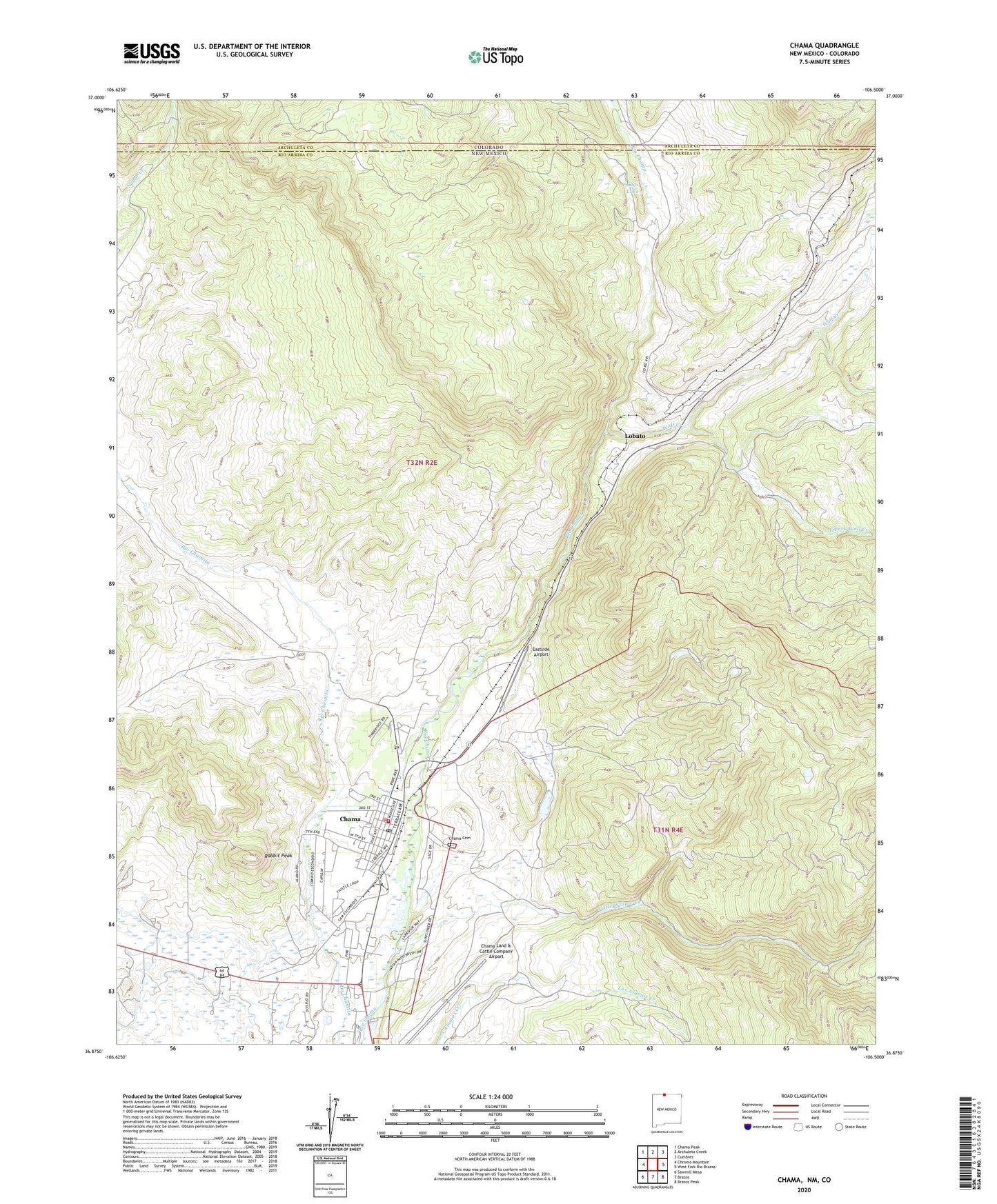
2020 topographic map quadrangle Chama in the state of New Mexico. Scale: 1:24000. Based on the newly updated USGS 7.5' US Topo map series, this map is in the following counties: Rio Arriba, Archuleta. The map contains contour data, water features, and other items you are used to seeing on USGS maps, but also has updated roads and other features. This is the next generation of topographic maps. Printed on high-quality waterproof paper with UV fade-resistant inks.
Quads adjacent to this one:
West: Chromo Mountain
Northwest: Chama Peak
North: Archuleta Creek
Northeast: Cumbres
East: West Fork Rio Brazos
Southeast: Brazos Peak
South: Brazos
Southwest: Sawmill Mesa
Contains the following named places: Burns-Kelly Store Historic Site, Chama, Chama Cemetery, Chama Church of Christ, Chama Elementary School, Chama Historical Marker, Chama Jail House Historic Site, Chama Land & Cattle Company Airport, Chama Police Department, Chama Post Office, Chama Volunteer Fire Department, Chama Weather Station, Cumbres and Toltec Scenic Railroad, Cumbres and Toltec Scenic Railroad Historical Marker, Cumbres Pass Historical Marker, Doctor J I Dunham Memorial Clinic, Dunham Log House Historic Site, East Fork Wolf Creek, Eastside Airport, Eleanor Daggett Memorial Library, First Baptist Church, Foster Hotel Historic Site, Kays Lake, Little Willow Creek, Lobato, M B Ditch, Rabbit Peak, Valley Gospel Fellowship Church, Village of Chama, Wolf Creek