MyTopo
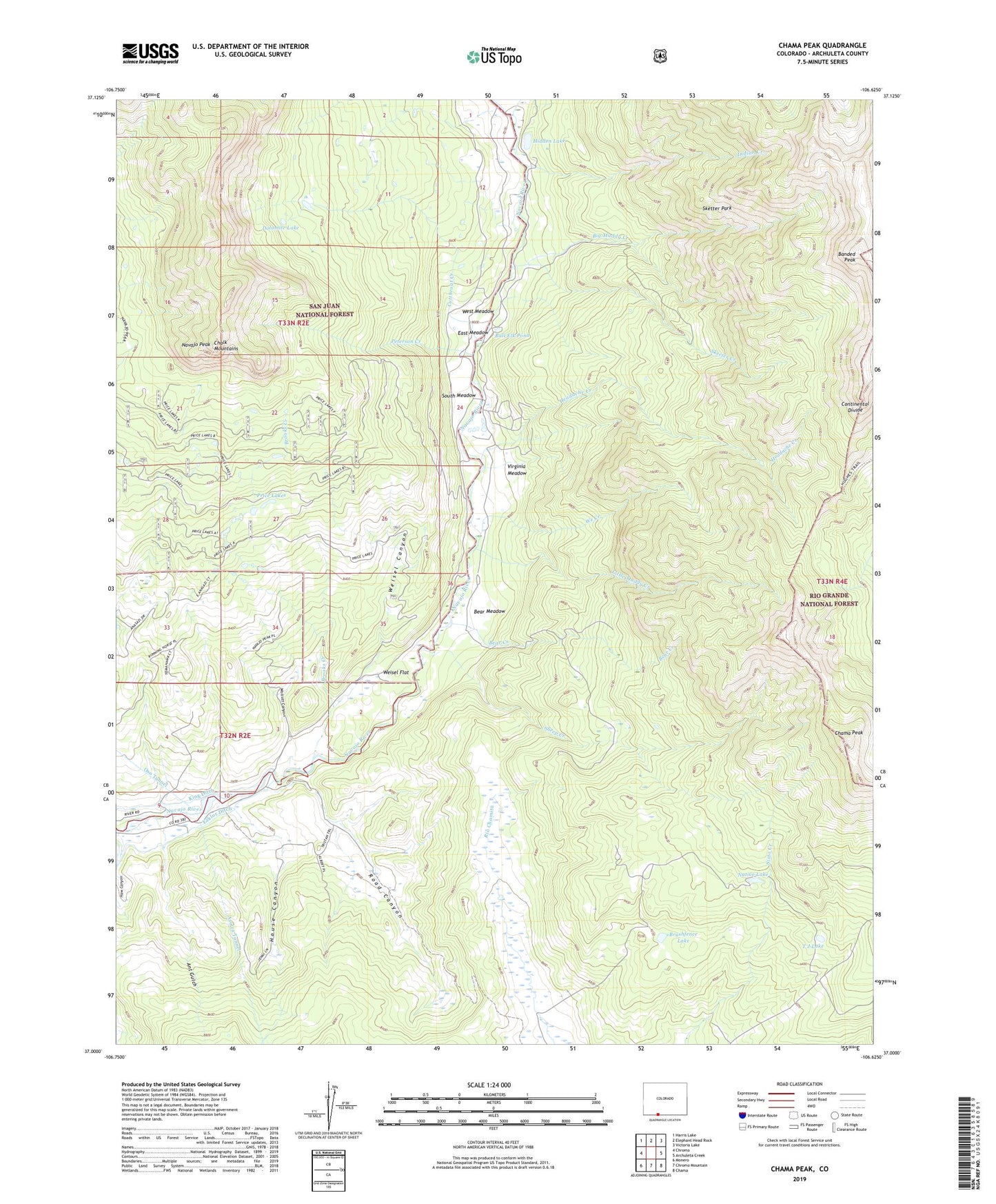
Chama Peak Colorado US Topo Map
Couldn't load pickup availability
Also explore the Chama Peak Forest Service Topo of this same quad for updated USFS data
2022 topographic map quadrangle Chama Peak in the state of Colorado. Scale: 1:24000. Based on the newly updated USGS 7.5' US Topo map series, this map is in the following counties: Archuleta. The map contains contour data, water features, and other items you are used to seeing on USGS maps, but also has updated roads and other features. This is the next generation of topographic maps. Printed on high-quality waterproof paper with UV fade-resistant inks.
Quads adjacent to this one:
West: Chromo
Northwest: Harris Lake
North: Elephant Head Rock
Northeast: Victoria Lake
East: Archuleta Creek
Southeast: Chama
South: Chromo Mountain
Southwest: Monero
This map covers the same area as the classic USGS quad with code o37106a6.
Contains the following named places: Ant Gulch, Banded Peak, Banded Peak Ranch, Bear Creek, Bear Meadow, Big Muddy Creek, Brooks Creek, Brushfence Lake, Bull Elk Pond, Chama Peak, Cutthroat Creek, Dolomite Lake, East Fork Navajo River, East Meadow, Gramps Oil Field, Haw Canyon, Headache Creek, Hidden Lake, House Canyon, Indian Creek, King Ditch, Little Muddy Creek, Lowe Camp, Native Lake, Navajo Peak, Oso Diversion Dam, Peterson Creek, Price Lakes, Road Canyon, Sheep Creek, Skeeter Creek, Sketter Park, South Meadow, T J Lake, Tierra Amarilla Grant, Virginia Meadow, We Creek, Weisel Canyon, Weisel Flat, West Meadow, Wolcott Canyon