MyTopo
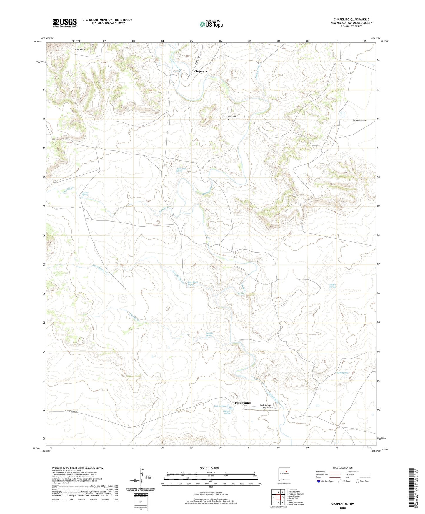
Chaperito New Mexico US Topo Map
Couldn't load pickup availability
2020 topographic map quadrangle Chaperito in the state of New Mexico. Scale: 1:24000. Based on the newly updated USGS 7.5' US Topo map series, this map is in the following counties: San Miguel. The map contains contour data, water features, and other items you are used to seeing on USGS maps, but also has updated roads and other features. This is the next generation of topographic maps. Printed on high-quality waterproof paper with UV fade-resistant inks.
Quads adjacent to this one:
West: Mesa Chupinas
Northwest: La Liendre
North: Mesa Lauriano
Northeast: Flagstone Mountain
East: Cactus Tank
Southeast: Horse Pasture Tank
South: Pedro Miguel Peak
Southwest: Dilia
Contains the following named places: Agua Azul Spring, Agua Media Creek, Agua Medio Spring, Aguila, Aguila Cemetery, Aguilar Creek, Aguilar Spring, Antonio Ortiz Grant, Chaperito, Chaperito Ditch, Chaperito Post Office, Chaperito Windmill, Coyote Spring, Culbertson Headquarters, East Mesa, Indio Arroyo, Ojo de la Gallina, Pamilla Creek, Pamilla Spring, Pamilla Windmill, Park Springs, Park Springs Airport, Park Springs Post Office, Park Springs Ranch Mine, Pecos Coal Mine, Salitre Arroyo, Salitre Spring, Tanka Grande Windmill, Tanke Grande