MyTopo
Pedro Miguel Peak New Mexico US Topo Map
Couldn't load pickup availability
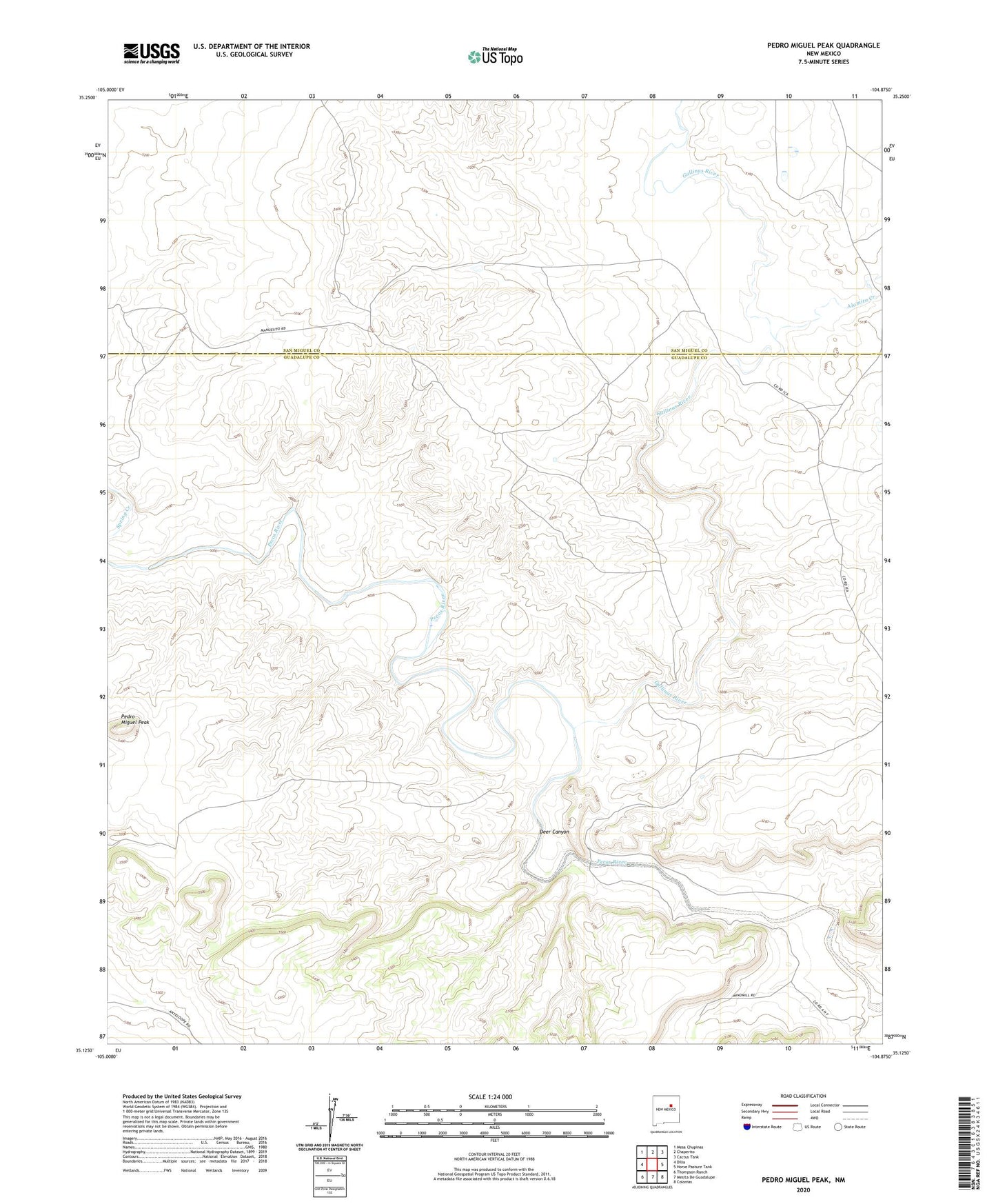
2023 topographic map quadrangle Pedro Miguel Peak in the state of New Mexico. Scale: 1:24000. Based on the newly updated USGS 7.5' US Topo map series, this map is in the following counties: Guadalupe, San Miguel. The map contains contour data, water features, and other items you are used to seeing on USGS maps, but also has updated roads and other features. This is the next generation of topographic maps. Printed on high-quality waterproof paper with UV fade-resistant inks.
Quads adjacent to this one:
West: Dilia
Northwest: Mesa Chupinas
North: Chaperito
Northeast: Cactus Tank
East: Horse Pasture Tank
Southeast: Colonias
South: Mesita De Guadalupe
Southwest: Thompson Ranch
This map covers the same area as the classic USGS quad with code o35104b8.
Contains the following named places: Alamito Creek, Deer Canyon, Gallinas River, North Camp, Pedro Miguel Peak, South Well, Sowell Ranch, Stage Stop Windmill, Tusero Windmill