MyTopo
Dilia New Mexico US Topo Map
Couldn't load pickup availability
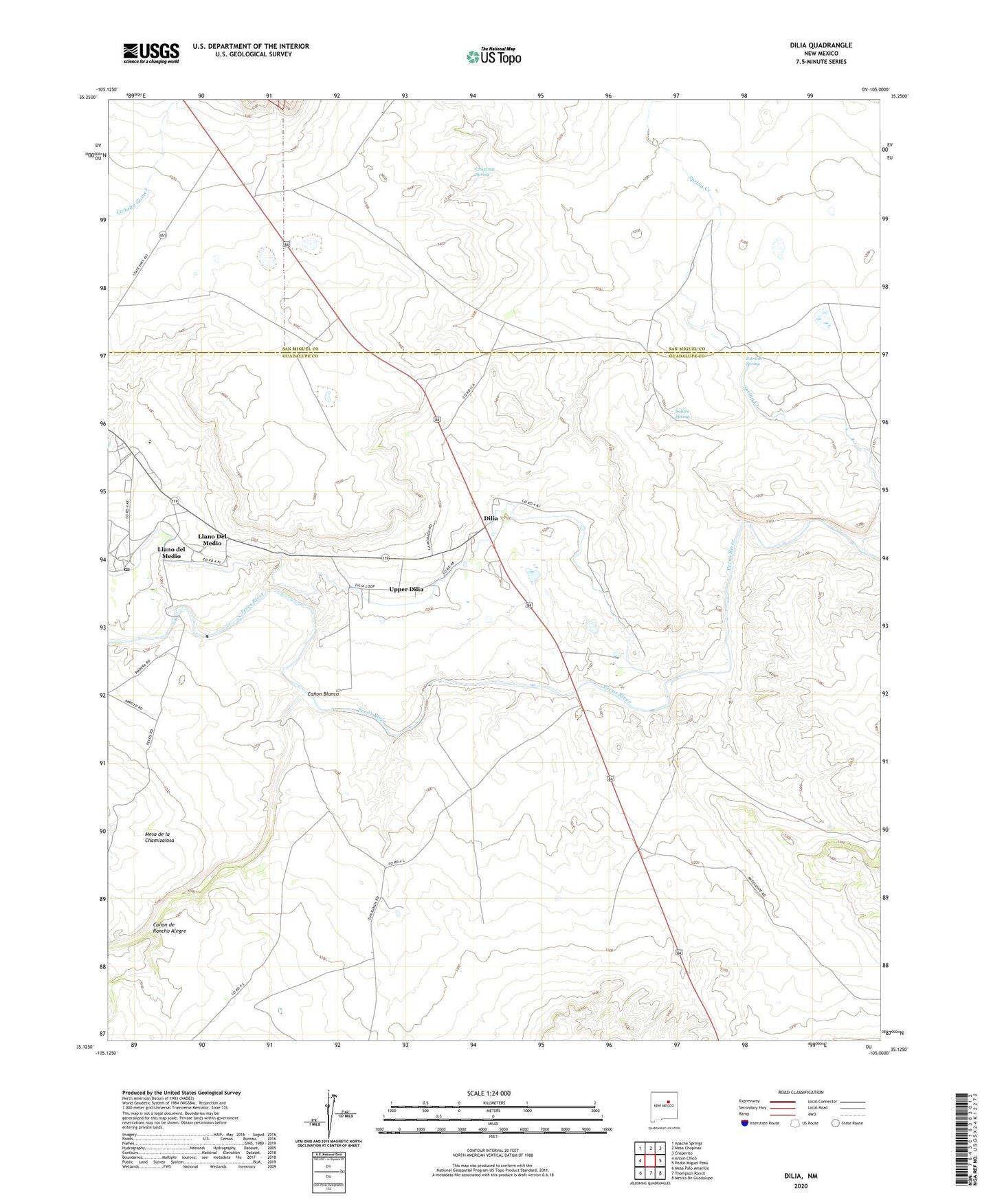
2023 topographic map quadrangle Dilia in the state of New Mexico. Scale: 1:24000. Based on the newly updated USGS 7.5' US Topo map series, this map is in the following counties: Guadalupe, San Miguel. The map contains contour data, water features, and other items you are used to seeing on USGS maps, but also has updated roads and other features. This is the next generation of topographic maps. Printed on high-quality waterproof paper with UV fade-resistant inks.
Quads adjacent to this one:
West: Anton Chico
Northwest: Apache Springs
North: Mesa Chupinas
Northeast: Chaperito
East: Pedro Miguel Peak
Southeast: Mesita De Guadalupe
South: Thompson Ranch
Southwest: Mesa Palo Amarillo
This map covers the same area as the classic USGS quad with code o35105b1.
Contains the following named places: Abercrombie Ranch, Acequia del Bodo Juan Paiz, Canon Blanco, Canon de Rancho Alegre, Chupinas Spring, Dilia, Dilia Post Office, Dilia Weather Station, Estritos Spring, La Loma Post Office, Llano Del Medio, Llano del Medio Census Designated Place, Sacred Heart Church, Salitre Spring, Sowell Ranch, Spring Creek, Upper Dilia, ZIP Codes: 87711, 87724