MyTopo
Mesa Lauriano New Mexico US Topo Map
Couldn't load pickup availability
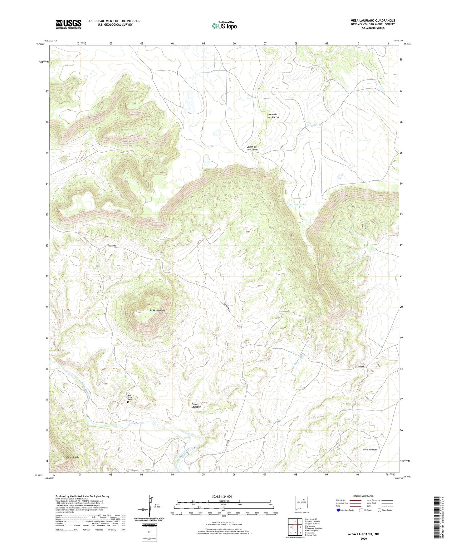
2023 topographic map quadrangle Mesa Lauriano in the state of New Mexico. Scale: 1:24000. Based on the newly updated USGS 7.5' US Topo map series, this map is in the following counties: San Miguel. The map contains contour data, water features, and other items you are used to seeing on USGS maps, but also has updated roads and other features. This is the next generation of topographic maps. Printed on high-quality waterproof paper with UV fade-resistant inks.
Quads adjacent to this one:
West: La Liendre
Northwest: Las Vegas SE
North: Laguna La Monia
Northeast: Laguna Huerfana
East: Flagstone Mountain
Southeast: Cactus Tank
South: Chaperito
Southwest: Mesa Chupinas
This map covers the same area as the classic USGS quad with code o35104d8.
Contains the following named places: Big Tank, Canon Lauriano, Hawk Windmill, Los Torres, Los Torres Cemetery, Los Torres Ditch, Mesa de los Carros, Mesa Lauriano, Mesa Montosa, Mesas Cuatas, Point Lake, San Lorenzo Shrine