MyTopo
Chinaberry Canyon New Mexico US Topo Map
Couldn't load pickup availability
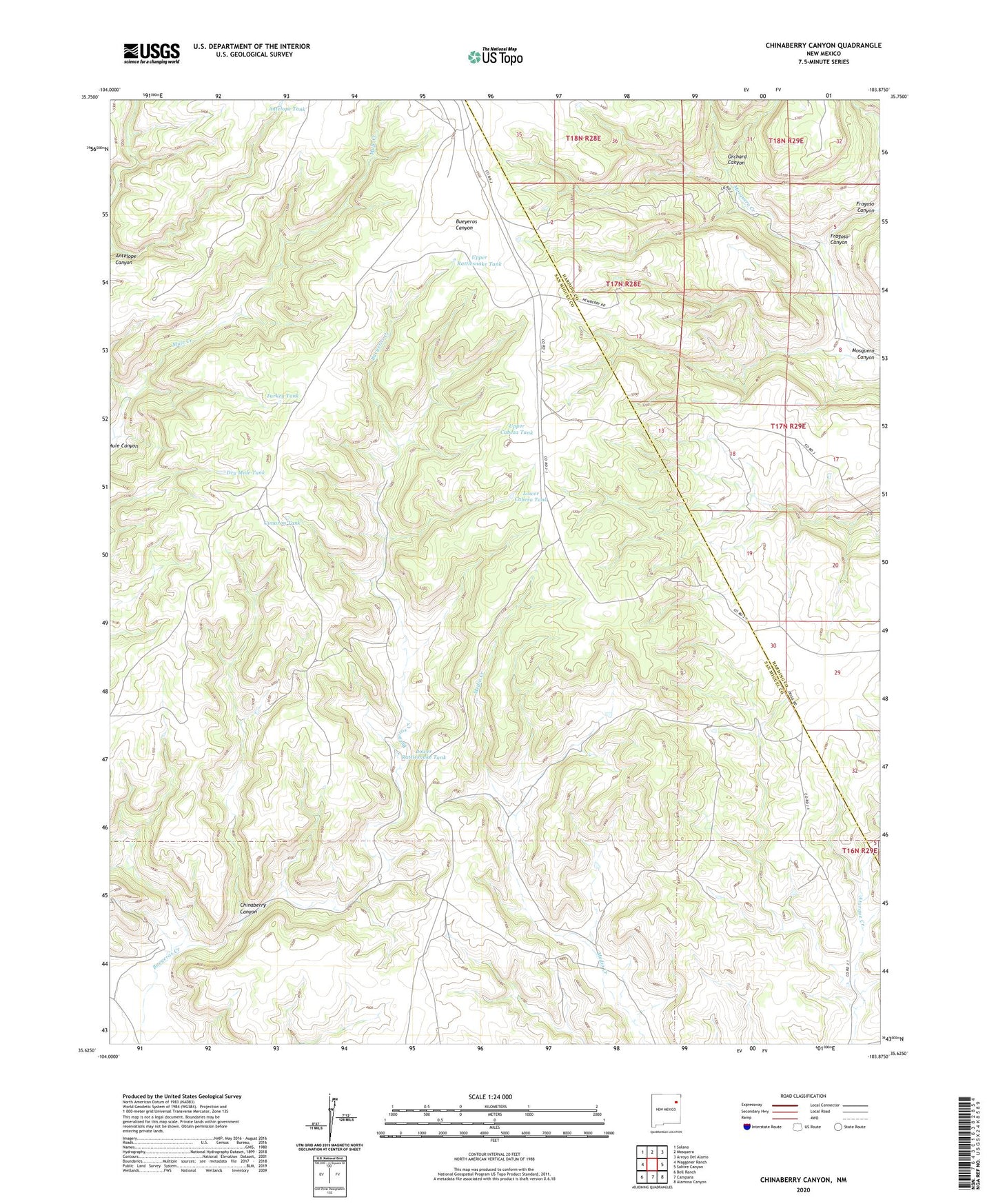
2023 topographic map quadrangle Chinaberry Canyon in the state of New Mexico. Scale: 1:24000. Based on the newly updated USGS 7.5' US Topo map series, this map is in the following counties: San Miguel, Harding. The map contains contour data, water features, and other items you are used to seeing on USGS maps, but also has updated roads and other features. This is the next generation of topographic maps. Printed on high-quality waterproof paper with UV fade-resistant inks.
Quads adjacent to this one:
West: Waggoner Ranch
Northwest: Solano
North: Mosquero
Northeast: Arroyo Del Alamo
East: Salitre Canyon
Southeast: Alamosa Canyon
South: Campana
Southwest: Bell Ranch
This map covers the same area as the classic USGS quad with code o35103f8.
Contains the following named places: Antelope Canyon, Antelope Tank, Cabeza, Chinaberry Canyon, Cimaron Tank, Dry Mule Tank, Fragoso Canyon, Juarez Windmill, Lower Cabeza Tank, Lower Medio Windmill, Lower Rattlesnake Tank, Lower Rattlesnake Windmill, Medio, Mitchel Windmill, Orchard Canyon, Polita Number Two, Turkey Tank, Upper Cabeza Tank, Upper Medio Windmill, Upper Rattlesnake Tank, Upper Rattlesnake Windmill