MyTopo
Arroyo Del Alamo New Mexico US Topo Map
Couldn't load pickup availability
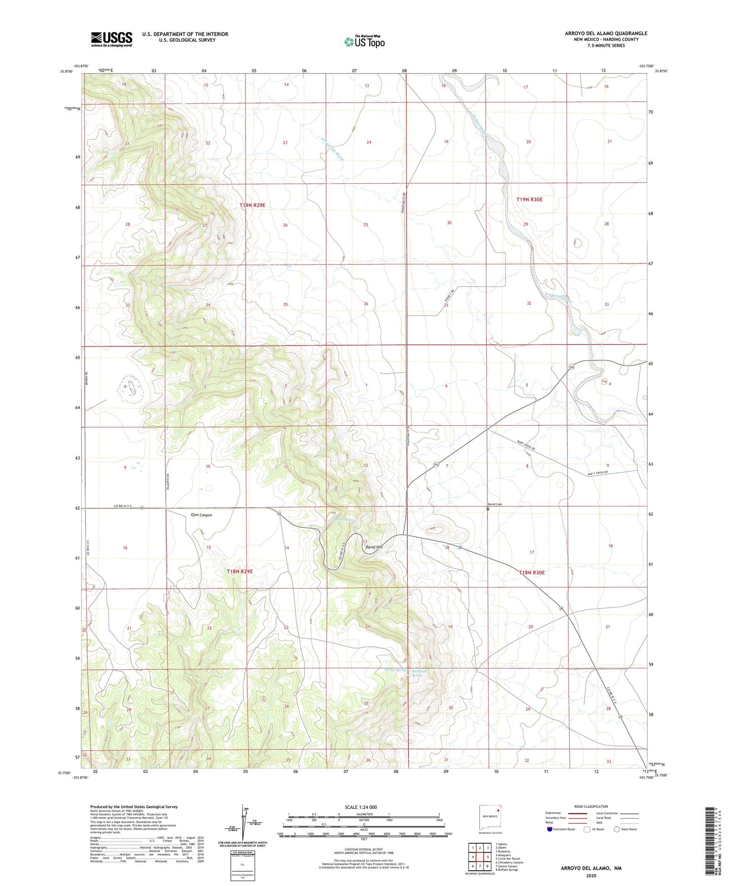
2023 topographic map quadrangle Arroyo Del Alamo in the state of New Mexico. Scale: 1:24000. Based on the newly updated USGS 7.5' US Topo map series, this map is in the following counties: Harding. The map contains contour data, water features, and other items you are used to seeing on USGS maps, but also has updated roads and other features. This is the next generation of topographic maps. Printed on high-quality waterproof paper with UV fade-resistant inks.
Quads adjacent to this one:
West: Mosquero
Northwest: Sabino
North: Albert
Northeast: Bueyeros
East: Circle Bar Ranch
Southeast: Buffalo Springs
South: Salitre Canyon
Southwest: Chinaberry Canyon
This map covers the same area as the classic USGS quad with code o35103g7.
Contains the following named places: Amerigas Number Sixteen Mitchell, Amerigas Number Twenty Mitchell, Amoco Number One State FM, Arbuckle, Bar T Cross Camp, Brown, Carbonic Number Five Mitchell, Carbonic Number Seven Mitchell, Carbonic Number Thirteen Mitchell, Carbonic Number Three Mitchell, Cedros Windmills, CO 2 Well, David Cemetery, David Hill, Harding County, Jake Windmill, McIntosh Spring, Parras Spring, Shrum, Tejano Spring, Waldron, ZIP Code: 87733