MyTopo
Mosquero New Mexico US Topo Map
Couldn't load pickup availability
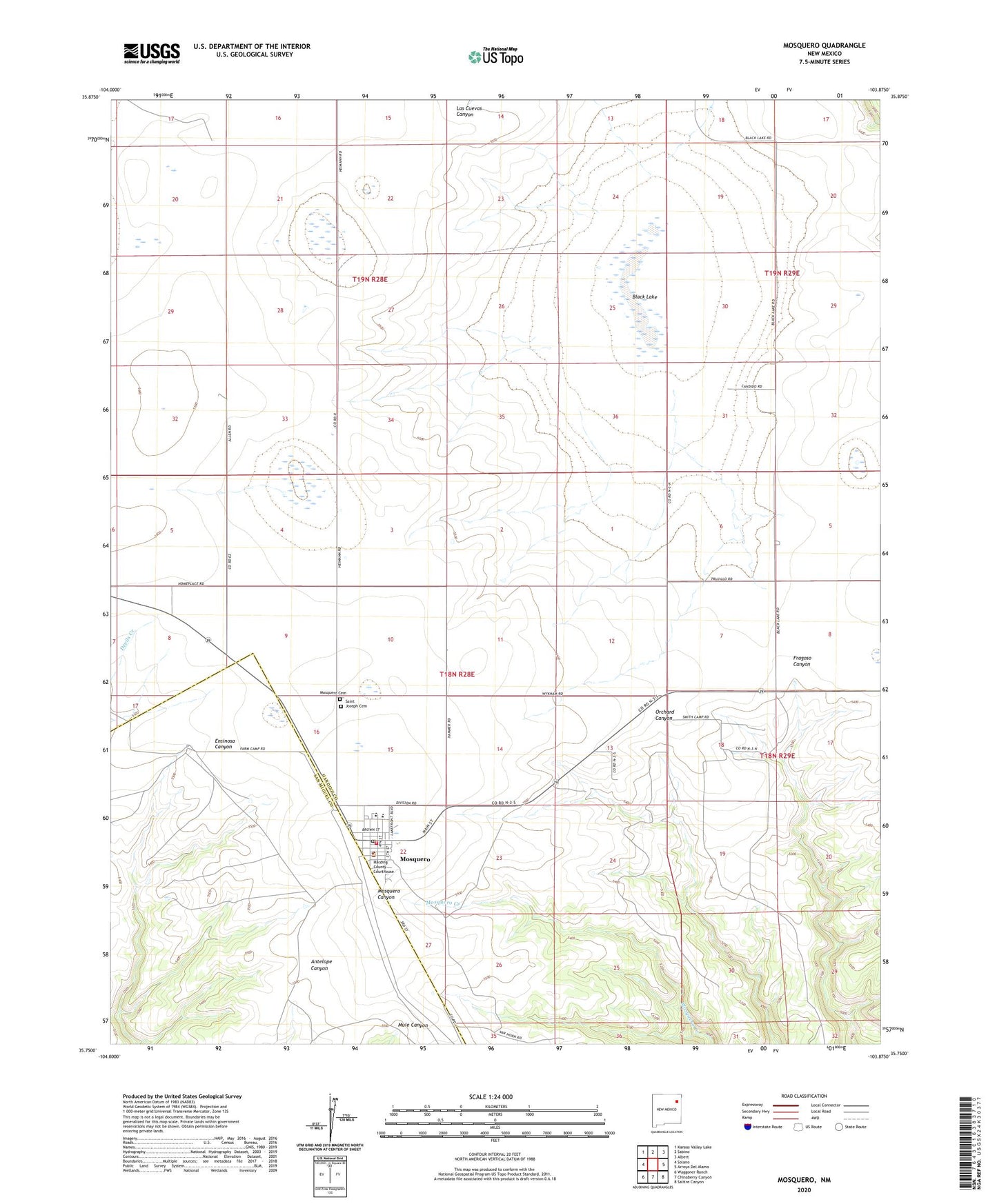
2023 topographic map quadrangle Mosquero in the state of New Mexico. Scale: 1:24000. Based on the newly updated USGS 7.5' US Topo map series, this map is in the following counties: Harding, San Miguel. The map contains contour data, water features, and other items you are used to seeing on USGS maps, but also has updated roads and other features. This is the next generation of topographic maps. Printed on high-quality waterproof paper with UV fade-resistant inks.
Quads adjacent to this one:
West: Solano
Northwest: Kansas Valley Lake
North: Sabino
Northeast: Albert
East: Arroyo Del Alamo
Southeast: Salitre Canyon
South: Chinaberry Canyon
Southwest: Waggoner Ranch
This map covers the same area as the classic USGS quad with code o35103g8.
Contains the following named places: Black Lake, Galey, Goodnight-Loving Trail Historical Marker, Harding County Courthouse, Harding County Sheriff's Office, McDaniels, Mosquero, Mosquero Cemetery, Mosquero Elementary School, Mosquero High School, Mosquero Post Office, Mosquero Village Police Department, Mosquero Volunteer Fire Department, Mosquero Weather Station, Saint Joseph Cemetery, Trujillo, Village of Mosquero, Wagoneer