MyTopo
Turkey Ridge New Mexico US Topo Map
Couldn't load pickup availability
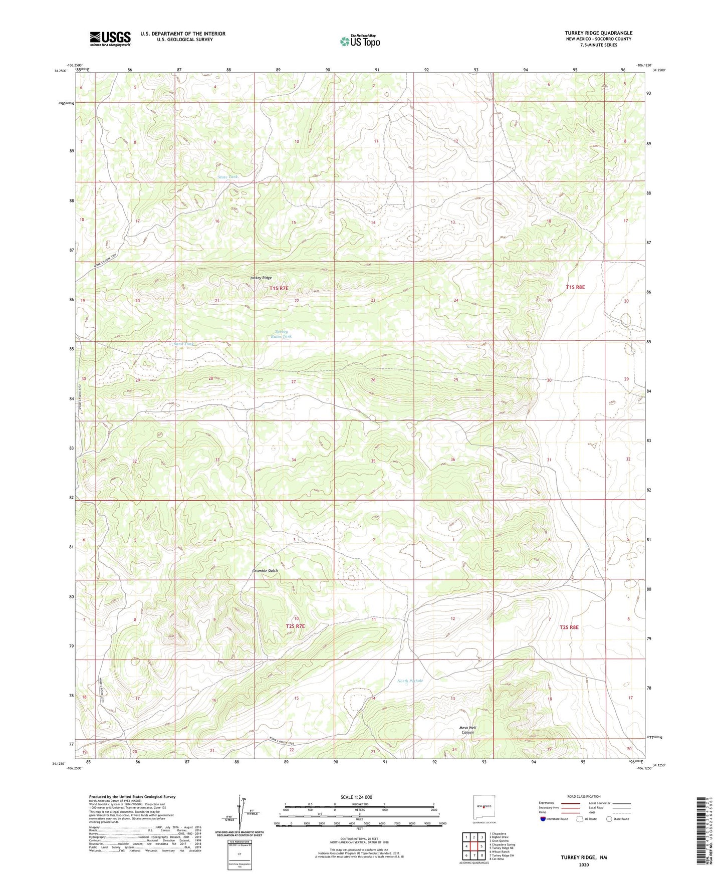
2023 topographic map quadrangle Turkey Ridge in the state of New Mexico. Scale: 1:24000. Based on the newly updated USGS 7.5' US Topo map series, this map is in the following counties: Socorro. The map contains contour data, water features, and other items you are used to seeing on USGS maps, but also has updated roads and other features. This is the next generation of topographic maps. Printed on high-quality waterproof paper with UV fade-resistant inks.
Quads adjacent to this one:
West: Chupadera Spring
Northwest: Chupadera
North: Bigbee Draw
Northeast: Gran Quivira
East: Turkey Ridge NE
Southeast: Cat Mesa
South: Turkey Ridge SW
Southwest: Wilson Ranch
This map covers the same area as the classic USGS quad with code o34106b2.
Contains the following named places: Axtell Well, Forest Well, Jerrett Well, Montezuma Well, North Pothole, Pothole Tank, Powell Well, Sand Tank, South Tank, State Tank, Turkey Ridge, Turkey Ruins Tank