MyTopo
Chupadera Spring New Mexico US Topo Map
Couldn't load pickup availability
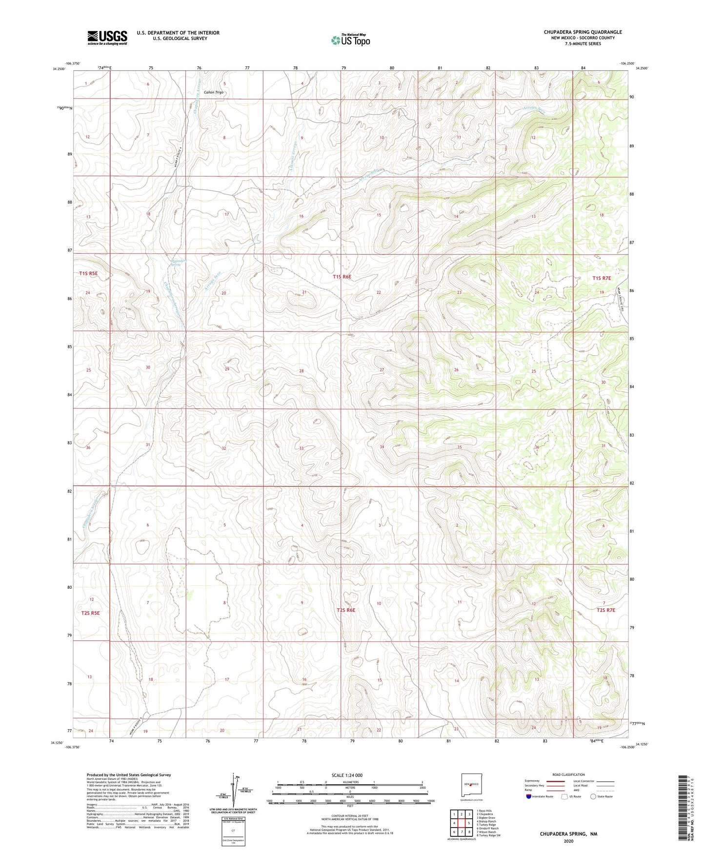
2023 topographic map quadrangle Chupadera Spring in the state of New Mexico. Scale: 1:24000. Based on the newly updated USGS 7.5' US Topo map series, this map is in the following counties: Socorro. The map contains contour data, water features, and other items you are used to seeing on USGS maps, but also has updated roads and other features. This is the next generation of topographic maps. Printed on high-quality waterproof paper with UV fade-resistant inks.
Quads adjacent to this one:
West: Bishop Ranch
Northwest: Rayo Hills
North: Chupadera
Northeast: Bigbee Draw
East: Turkey Ridge
Southeast: Turkey Ridge SW
South: Wilson Ranch
Southwest: Orndorff Ranch
This map covers the same area as the classic USGS quad with code o34106b3.
Contains the following named places: Alamito Arroyo, Arroyo Seco, Canon Trigo, Chupadera Spring, East Well, Forest Well, Indian Well, North Well, South Well, Spring Well