MyTopo
Clements Ranch New Mexico US Topo Map
Couldn't load pickup availability
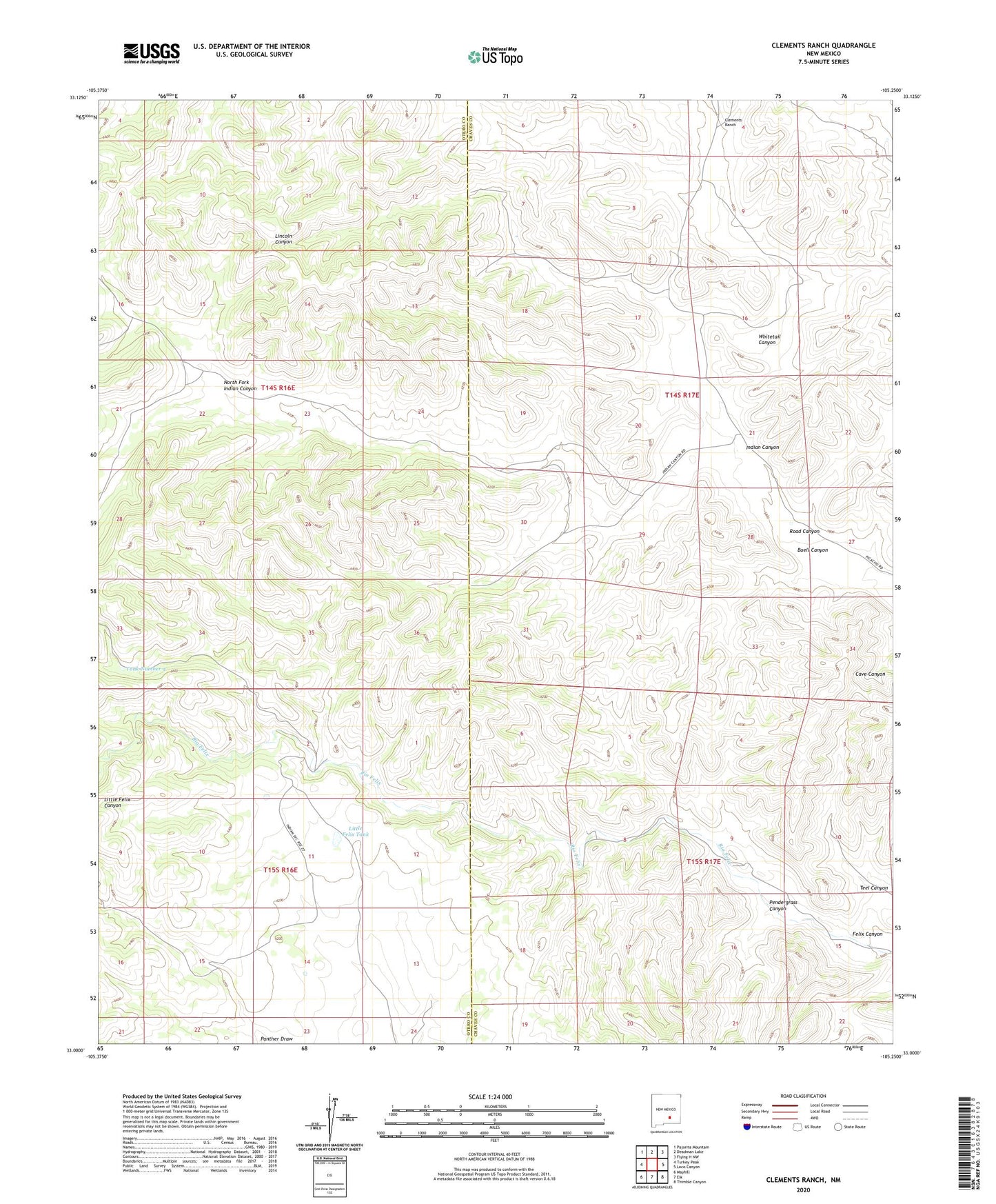
2020 topographic map quadrangle Clements Ranch in the state of New Mexico. Scale: 1:24000. Based on the newly updated USGS 7.5' US Topo map series, this map is in the following counties: Otero, Chaves. The map contains contour data, water features, and other items you are used to seeing on USGS maps, but also has updated roads and other features. This is the next generation of topographic maps. Printed on high-quality waterproof paper with UV fade-resistant inks.
Quads adjacent to this one:
West: Turkey Peak
Northwest: Pajarita Mountain
North: Deadman Lake
Northeast: Flying H NW
East: Loco Canyon
Southeast: Thimble Canyon
South: Elk
Southwest: Mayhill
Contains the following named places: Buell Canyon, Calentine Well, Clements Ranch, Indian Canyon, Indian Well, Janes Well, Little Felix Tank, Lower Indian Well, McCarty Well, North Fork Indian Canyon, Panther Well, Pendergrass Canyon, Pendergrass Well, Road Canyon, Tank Number 4, Taylor Well, Teel Canyon, Teel Canyon Well, Teel Well, Whitetail Canyon, Willow Well