MyTopo
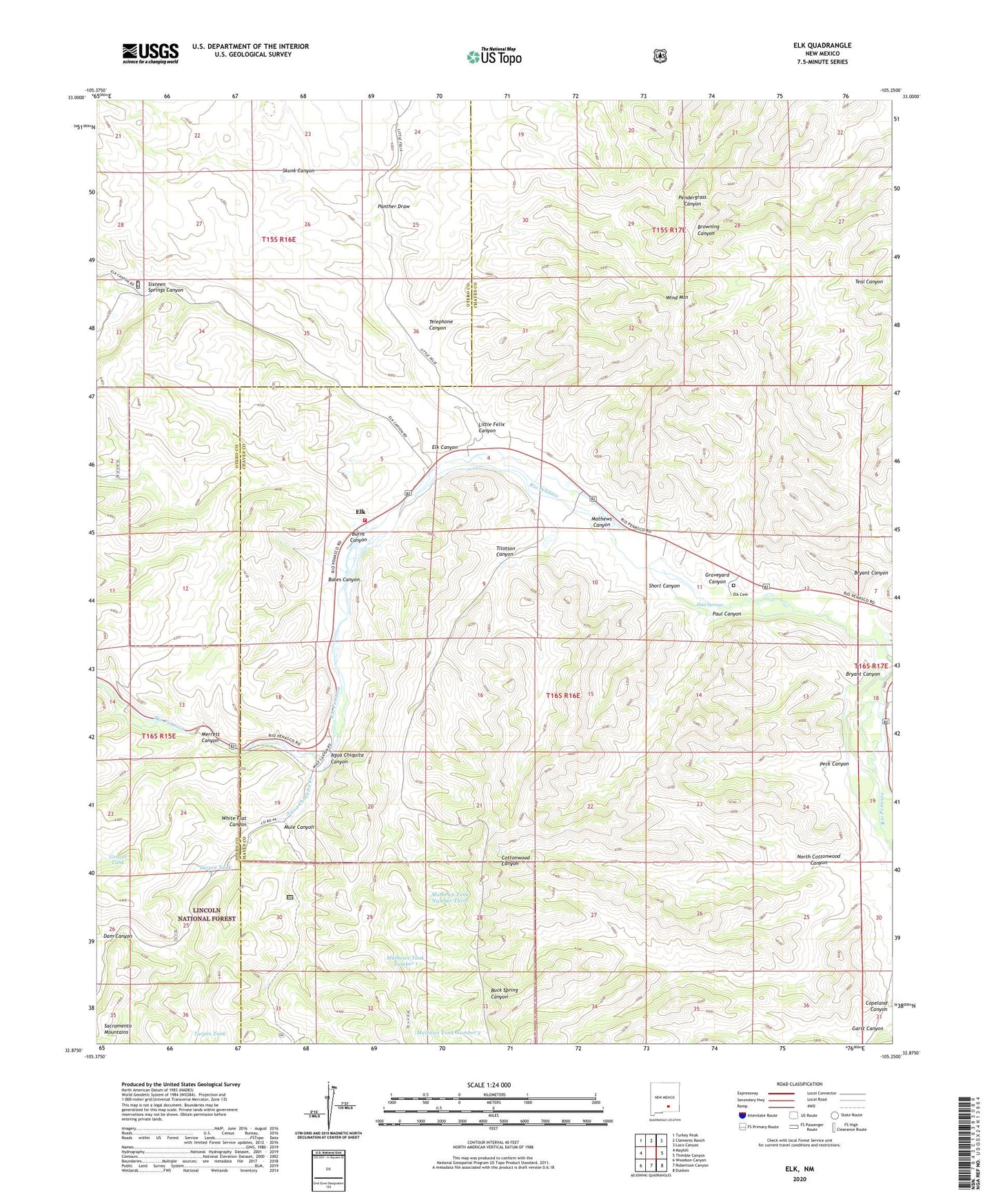
Elk New Mexico US Topo Map
Couldn't load pickup availability
Also explore the Elk Forest Service Topo of this same quad for updated USFS data
2023 topographic map quadrangle Elk in the state of New Mexico. Scale: 1:24000. Based on the newly updated USGS 7.5' US Topo map series, this map is in the following counties: Chaves, Otero. The map contains contour data, water features, and other items you are used to seeing on USGS maps, but also has updated roads and other features. This is the next generation of topographic maps. Printed on high-quality waterproof paper with UV fade-resistant inks.
Quads adjacent to this one:
West: Mayhill
Northwest: Turkey Peak
North: Clements Ranch
Northeast: Loco Canyon
East: Thimble Canyon
Southeast: Dunken
South: Robertson Canyon
Southwest: Woodson Canyon
This map covers the same area as the classic USGS quad with code o32105h3.
Contains the following named places: 10356 Water Well, 10357 Water Well, 10358 Water Well, 10359 Water Well, 10360 Water Well, 10361 Water Well, 10362 Water Well, 10636 Water Well, 10637 Water Well, 10638 Water Well, 10639 Water Well, 10640 Water Well, 10641 Water Well, 10642 Water Well, 10643 Water Well, 10644 Water Well, 10645 Water Well, 12770 Water Well, Agua Chiquita Canyon, Agua Chiquita Creek, Bates Canyon, Bryant Canyon, Burnt Canyon, Crockett Ranch, Dam Canyon, Elk, Elk Canyon, Elk Cemetery, Elk Post Office, Elk Weather Station, Garst Canyon, Gravel Tank, Graveyard Canyon, J B Runyan Ranch, Little Felix Canyon, Mathews Canyon, Mathews Tank Number 1, Mathews Tank Number 2, Mathews Tank Number Three, Merrett Canyon, Mule Canyon, North Cottonwood Canyon, North Pasture Windmill, Panther Draw, Paul Canyon, Paul Springs, Peck Canyon, Penasco Volunteer Fire Department Station 2, Pine Tank, Short Canyon, Sixteen Springs Canyon, Skunk Canyon, Telephone Canyon, Tilotson Canyon, Turpin Tank, White Flat Canyon, Wind Mountain