MyTopo
Deadman Lake New Mexico US Topo Map
Couldn't load pickup availability
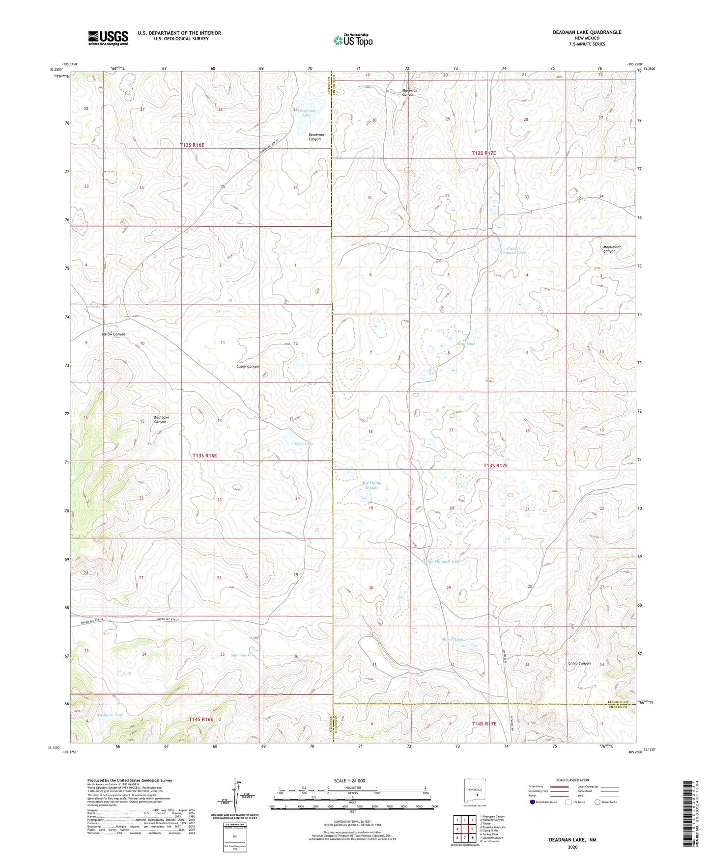
2023 topographic map quadrangle Deadman Lake in the state of New Mexico. Scale: 1:24000. Based on the newly updated USGS 7.5' US Topo map series, this map is in the following counties: Otero, Lincoln, Chaves. The map contains contour data, water features, and other items you are used to seeing on USGS maps, but also has updated roads and other features. This is the next generation of topographic maps. Printed on high-quality waterproof paper with UV fade-resistant inks.
Quads adjacent to this one:
West: Pajarita Mountain
Northwest: Sheeppen Canyon
North: Wahalee Canyon
Northeast: Tinnie
East: Flying H NW
Southeast: Loco Canyon
South: Clements Ranch
Southwest: Turkey Peak
This map covers the same area as the classic USGS quad with code o33105b3.
Contains the following named places: Big Flying H Lake, Burro Lake, Circle Diamond Lake, Deadman Canyon, Deadman Lake, Deep Lake, Indian Windmill, Joyce Ranch, Lake Windmill, Little Flying H Lake, Monument Canyon, Red Lake, Red Lake Canyon, Rosendo Windmill, Spur Tank, Spur Well, Washpan Tank, Whitetail Windmill, Yellow Canyon