MyTopo
Loco Canyon New Mexico US Topo Map
Couldn't load pickup availability
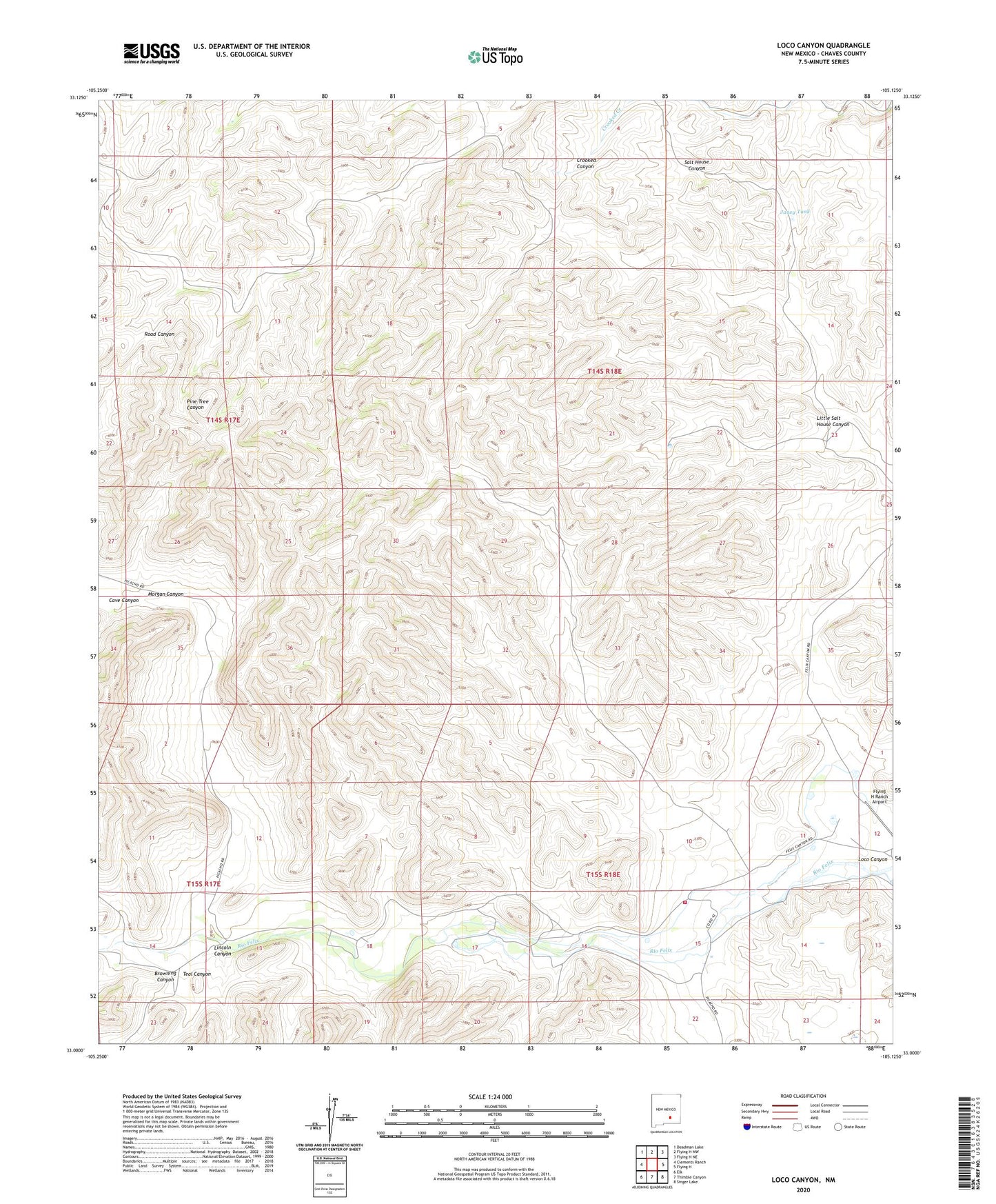
2023 topographic map quadrangle Loco Canyon in the state of New Mexico. Scale: 1:24000. Based on the newly updated USGS 7.5' US Topo map series, this map is in the following counties: Chaves. The map contains contour data, water features, and other items you are used to seeing on USGS maps, but also has updated roads and other features. This is the next generation of topographic maps. Printed on high-quality waterproof paper with UV fade-resistant inks.
Quads adjacent to this one:
West: Clements Ranch
Northwest: Deadman Lake
North: Flying H NW
Northeast: Flying H NE
East: Flying H
Southeast: Singer Lake
South: Thimble Canyon
Southwest: Elk
This map covers the same area as the classic USGS quad with code o33105a2.
Contains the following named places: Alto Well, Browning Canyon, Cave Canyon, Felix Canyon, Funk, Janey Tank, Joy Ranch, Lincoln Canyon, Little Salt House Canyon, Little Salt House Well, Loco Canyon, Luis Well, Morgan Canyon, Old Loco Well, R Vandewart Ranch, Rio Felix Volunteer Fire Department, Salt House, Upper Loco Well