MyTopo
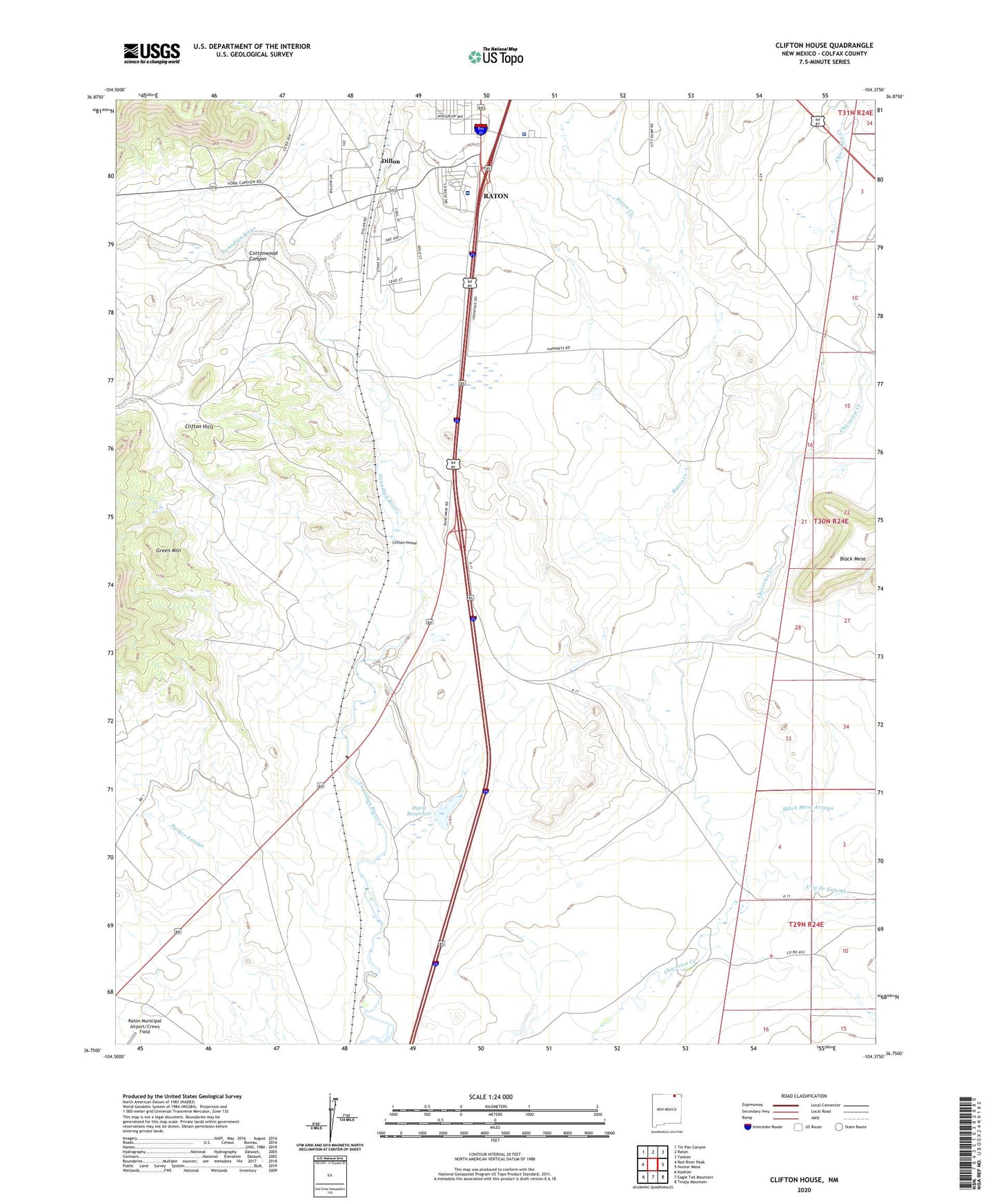
Clifton House New Mexico US Topo Map
Couldn't load pickup availability
2023 topographic map quadrangle Clifton House in the state of New Mexico. Scale: 1:24000. Based on the newly updated USGS 7.5' US Topo map series, this map is in the following counties: Colfax. The map contains contour data, water features, and other items you are used to seeing on USGS maps, but also has updated roads and other features. This is the next generation of topographic maps. Printed on high-quality waterproof paper with UV fade-resistant inks.
Quads adjacent to this one:
West: Red River Peak
Northwest: Tin Pan Canyon
North: Raton
Northeast: Yankee
East: Hunter Mesa
Southeast: Tinaja Mountain
South: Eagle Tail Mountain
Southwest: Koehler
This map covers the same area as the classic USGS quad with code o36104g4.
Contains the following named places: Black Mesa Arroyo, Clifton Hills, Clifton House, Clifton House Site Historical Marker, Cottonwood Canyon, Davis Reservoir, Davis Reservoir Dam, Dillon, Green Mountain, La Mesa Park, La Mesa Park Airport, Miners' Colfax Medical Center, Moore, Moore Pit, New Mexico State Police District 2 Raton, Raton Creek, Raton Division, Stockton, Una de Gato Creek