MyTopo
Red River Peak New Mexico US Topo Map
Couldn't load pickup availability
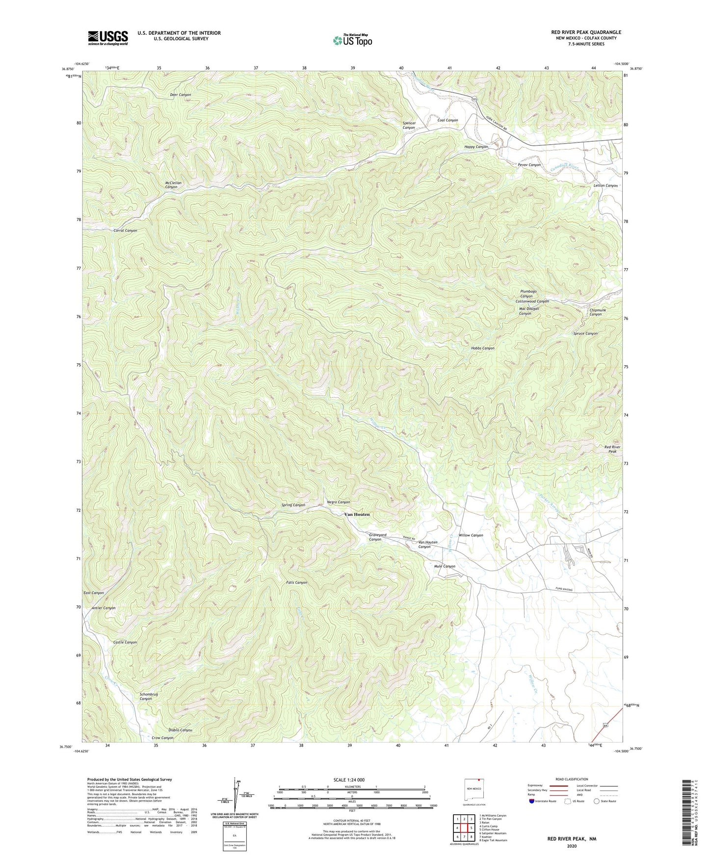
2023 topographic map quadrangle Red River Peak in the state of New Mexico. Scale: 1:24000. Based on the newly updated USGS 7.5' US Topo map series, this map is in the following counties: Colfax. The map contains contour data, water features, and other items you are used to seeing on USGS maps, but also has updated roads and other features. This is the next generation of topographic maps. Printed on high-quality waterproof paper with UV fade-resistant inks.
Quads adjacent to this one:
West: Curtis Camp
Northwest: McWilliams Canyon
North: Tin Pan Canyon
Northeast: Raton
East: Clifton House
Southeast: Eagle Tail Mountain
South: Koehler
Southwest: Saltpeter Mountain
This map covers the same area as the classic USGS quad with code o36104g5.
Contains the following named places: Antler Canyon, Castle Canyon, Chipmunk Canyon, Coal Canyon, Corral Canyon, Diablo Canyon, East Canyon, Graphite Prospect, Graveyard Canyon, Happy Canyon, Hobbs Canyon, Letton Canyon, Mac Dougall Canyon, McClellan Canyon, Mule Canyon, Negro Canyon, Ox Canyon Mine, Pevov Canyon, Plumbago Canyon, Preston, Red River Peak, Schombrug Canyon, Spencer Canyon, Spring Canyon, Spruce Canyon, Standard Graphite Company Prospect, Van Houten, Van Houten Canyon, Van Houten Number Four, Van Houten Number One Mine, Van Houten Post Office, Willow Canyon, Willow Numbers Five and Six Mines